Thursday, January 28th, 2021
WASHINGTON and AUSTIN, Texas - MEASURE, a leading aerial intelligence company, has shipped a major expansion of its drone software platform Ground Control. The update features improved data processing and analytics capabilities and equips users to create enhanced data products....
Thursday, January 28th, 2021
PITTSBURGH - VISIMO, in partnership with the University of Cincinnati (UC) Unmanned Aerial Vehicle Multi-Agent Systems Technology Research (UAV MASTER) Lab, has won an Air Force "Agility Prime" Phase I Small Business Technology Transfer (STTR) award to conduct research on...
Wednesday, January 27th, 2021
DENVER, Colorado – TCarta Marine, a global provider of hydrospatial solutions, has introduced a Global Satellite Derived Bathymetry (G-SDB) product line developed with a new seafloor depth measurement technique that leverages Machine Learning and NASA ICESat-2 laser...
Wednesday, January 27th, 2021
BERLIN, Germany / NEW YORK, USA - For the first time in history, vegetation encroachment risk to the entire publicly available U.S. transmission grid has been analyzed from space by the Berlin-based start-up LiveEO. The goal of...

Tuesday, January 26th, 2021
Led by the SmartSat Cooperative Research Centre (CRC), the AUD$6.5 million SASAT1 Space Services Mission was announced in Adelaide, South Australia. Based at Lot Fourteen, which is also home to the Australian Space Agency, the SmartSat Cooperative...
Tuesday, January 26th, 2021
GUANGZHOU, China - The UN warned last week that East Africa remains under the threat of desert locust invasions, due to the prevailing favourable breeding conditions which enable new swarms to form and increase. As African countries are getting prepared...
Tuesday, January 26th, 2021
ORLANDO, Fla.- Red Cat Holdings, Inc. (OTCQB: RCAT) ("Red Cat"), announced the signing of a letter of intent to acquire Skypersonic Inc., a provider of drone products and software solutions. Skyloc is a stand-alone, real time, software monitoring...
Tuesday, January 26th, 2021
HOLLYWOOD, Fla.– NV5 Geospatial, North America’s largest provider of geospatial data services and solutions, will share ground-breaking research on the use of low altitude drone and rotary wing lidar surveys for transportation applications during the 2021 Transportation...
Tuesday, January 26th, 2021
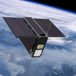
An optical sensor manufactured by ABB was deployed last night with the successful launch of satellite Hugo from GHGSat, the emerging leader in greenhouse gas sensing services in space. The ABB supplied optical sensor can map methane...
Tuesday, January 26th, 2021
TORONTO, Ontario, Canada – Space Flight Laboratory (SFL), a developer of complete microspace missions, today announced the launch and successful deployment of 12 satellites on January 24, 2021. The SpaceX Falcon 9 ride-sharing mission carried three different...