Wednesday, March 10th, 2021
REDMOND, Wash. - EarthDefine, a provider of high-resolution geospatial products, announced the release of the most detailed and comprehensive assessment of built-up surfaces in the United States. EarthDefine released the 1-meter resolution US Impervious Map and US Parking Lots products, adding two...
Wednesday, March 10th, 2021
Allvision's asset management solution now offers data coverage PITTSBURGH - Allvision IO, a geospatial analytics company providing insights and asset management to the transportation sector with specific applications for urban mobility, rail and road asset owners, announced...
Wednesday, March 10th, 2021
LOWELL, Mass. - ePropelled, the Massachusetts-based technology company offering leading-edge electromagnetic systems, unveils today the next-generation family of power generation and propulsion products for UAV and other aviation applications. The ePropelled UAV product line consists of starter generators, intelligent...
Wednesday, March 10th, 2021
URISA and the International Association of Assessing Officers (IAAO) are pleased to announce the featured speakers for the 2021 GIS/Valuation Technologies Conference (formerly known as GIS/CAMA). For 24 years, this conference has been the favorite annual event...
Wednesday, March 10th, 2021
Five former government officials with military and intelligence leadership experience have joined the 2021 class of advisory board members at Herndon, Virginia-based geospatial analytics company HawkEye 360. HawkEye 360 said Tuesday its newly appointed advisers are Kevin Chilton, a...
Wednesday, March 10th, 2021
Los Angeles, CA.- Draganfly Inc. (OTCQB: DFLYF) (CSE: DFLY) (FSE: 3U8) (“Draganfly” or the “Company”), award-winning, industry-leading drone solutions, and systems developer, today announced that it has entered into an agreement with the Southern Alberta Institute of...
Wednesday, March 10th, 2021
Waterloo, CANADA- Teledyne Imaging, part of Teledyne Technologies , is proud to introduce COSMOS™, large-format, back side illuminated (BSI) CMOS cameras optimized for astronomy. Exclusively developed by Teledyne Imaging, COSMOS draws on decades of expertise in...
Wednesday, March 10th, 2021
FORT COLLINS, Colorado, USA, - Remote GeoSystems, Inc., a global provider of immersive geospatial full motion video and survey data mapping software and recorder solutions, is pleased to announce the award of US Patent Number 10,893,287 on...

Tuesday, March 9th, 2021
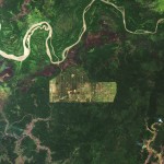
Although it covers just 1 percent of Earth’s land surfaces, Indonesia’s rainforest is believed to shelter 10 percent of the world’s known plant species, 12 percent of mammal species and 17 percent of bird species. Spread across...
Tuesday, March 9th, 2021
dvancing the Interoperability of Geospatial Intelligence Tradecraft with 3D Modeling, Simulation, and Game Engines Herndon, Virginia —The United States Geospatial Intelligence Foundation (USGIF), in cooperation with the Open Geospatial Consortium (OGC), published a technical paper, Advancing the Interoperability...