Tuesday, June 1st, 2021
GRAND JUNCTION, Colo. - ProStar Holdings Inc ("ProStar®" or the "Company") (TSXV: MAPS) (FSE: 5D00), a world leader in Precision Mapping Solutions®, and developer of PointMan®, announced today that Kraemer® North America, a top-ranked U.S. national heavy civil contractor with...
Tuesday, June 1st, 2021
Panzura announced that DCIG, a leading IT industry research firm, has named Panzura CloudFS global file system to its list of “TOP 5 Enterprise Multi-site File Collaboration Solutions.” In a new report that is now available for download, DCIG provides...
Tuesday, June 1st, 2021
DENVER - Propeller Aero, the drone data visualization and analytics platform and Wingtra, the professional Vertical Take Off and Landing (VTOL) drone manufacturer for mapping and surveying, have joined forces to deliver highly accurate site data and 3D mapping...

Tuesday, June 1st, 2021
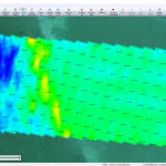
Israeli drone service provider ERELIS recently conducted a number of pilot projects using a drone equipped with a single-beam echo sounder in the Mediterranean and Dead Seas. The data was validated by authorized local surveyors and reports...
Tuesday, June 1st, 2021
AARSCHOT, Belgium, 1 June 2021 – Calculating and reporting stockpile inventories are now easier and faster in the latest version of the Virtual Surveyor drone surveying software. Virtual Surveyor Version 8.2 allows users to accurately calculate stockpile...
Tuesday, June 1st, 2021
New Compact, Cost-Effective Package Enables Easy Integration for High-Volume Range Finding and LiDAR Applications WALTHAM, Mass. – Excelitas TechnologiesÒ Corp., a global technology leader delivering innovative, customized photonic solutions, today announced its new high speed, large area...
Friday, May 28th, 2021
Singapore’s national water agency PUB is deploying autonomous drones at six of the country’s reservoirs to monitor water quality and other activities following trials last year. Read More at Computer Weekly
Friday, May 28th, 2021
Robots and artificial intelligence will replace workers on Australia's first fully automated farm created at a cost of $20 million. Read More at ABC.Net
Friday, May 28th, 2021
RIYADH — The General Authority for Survey and Geospatial Information (GASGI) has launched the second improved and updated version of the National Geospatial Platform as part of its efforts in developing the geospatial infrastructure. Read More at Saudi...
Friday, May 28th, 2021
CSIR-National Environmental Engineering Research Institute (CSIR-NEERI), Nagpur added a feather in its cap by conducting the largest and first ever GIS-based mapping of Microbial Diversity of river Ganga recently. An enthusiastic team with the partnership of four...