Thursday, May 11th, 2017
Chantilly, VA — Contex, the leader of wide format scanning and imaging solutions, today announces an update to the SD One MF wide format scanner. The market’s first wireless connected scanner now allows customers to connect a...
Thursday, May 11th, 2017
Blue Marble Geographics (bluemarblegeo.com) is pleased to announce the immediate availability of a beta release of the Android version of its popular Global Mapper Mobile app. Mirroring the capabilities of the iOS version released in June of...
Thursday, May 11th, 2017
(TOKYO, BERN, BERLIN & MIRI) This week, activists from around the world are staging protests demanding an immediate halt to the use of tropical wood for construction of the new Olympic facilities in Tokyo. On Wednesday, over...
Wednesday, May 10th, 2017
NASHVILLE, Tenn. - GEO Jobe is pleased to announce milestone statistics for the popular Admin Tools for ArcGIS Online. Recall, with the latest update of Admin Tools for ArcGIS Online to V 1.0.13, the ArcGIS Administrator has...
Wednesday, May 10th, 2017
DALLAS, May 10, 2017 -- Airbus (stock exchange symbol: AIR) today launched its U.S. base and operations of a new commercial drone start-up, named Airbus Aerial, at the AUVSI Xponential tradeshow and conference in Dallas. With bases...
Wednesday, May 10th, 2017
SAN DIEGO - RippleNami, Inc., a provider of a map-based data visualization platform accessed via the cloud, announced today that it earned two gold and one silver Stevie® Awards in three categories of The 15th Annual American...
Wednesday, May 10th, 2017
ALSO today announced the company will begin distributing HP's Jet Fusion 3D printing solution across Europe (excluding the UK and the Republic of Ireland). "Given that 3D printing has been defined as a strategic segment for the...
Wednesday, May 10th, 2017
BOTHELL, Wash.-EagleView Technology Corporation (“EagleView®”), a leading technology provider of aerial imagery, data analytics and GIS solutions, is encouraged by recent developments in its ongoing litigation against Xactware and Verisk for infringement of EagleView’s patents. The case...

Tuesday, May 9th, 2017
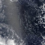
Areas near the equator are frequently cloudy, obscuring the view of Earth’s surface from space. April 7, 2017, was no different. On that day, the Moderate Resolution Imaging Spectroradiometer (MODIS) on NASA’s Terra satellite captured this natural-color...
Tuesday, May 9th, 2017
May 9, 2017 — Teledyne Optech is pleased to announce that it is displaying its latest airborne and terrestrial lidar solutions for acquiring accurate geospatial data at GEO Business 2017 in London on 23-24 May 2017, and...