Asian Surveying & Mapping
Breaking News
Launch of Australia’s 1st orbital rocket, Gilmour Space’s Eris-1, delayed again
Update for 6:15 p.m. ET on July 1: Gilmour Space...
SAASST, UAE Space Agency strengthen scientific partnership
SHARJAH- Prof. Hamid M.K. Al Naimiy, Director of the...
Shubhanshu Shukla to speak to students and ISRO scientists this Friday
Indian astronaut Shubhanshu Shukla will interact with school students...
ISRO hands over 10 advanced technologies to Indian firms in major push for space commercialisation
The Indian Space Research Organisation (ISRO) has transferred ten...
DIGIPIN Launched: India Embraces Geospatial Precision in Digital Addressing
IIT Hyderabad (IITH), in partnership with the Department of...
HAL to build, market Isro’s SSLV in landmark deal
New Delhi, Jun 20: In a historic move for...
Taiwan developing space capabilities for all-weather imaging
TAIPEI (TVBS News) — Taiwan is advancing its space...
Honda hails successful test of reusable rocket as it looks to get into the space business
Tokyo — Japan's second-biggest carmaker, Honda, has successfully tested...
China’s space program provides larger platform for broader international cooperation
BEIJING -- Experts from China's manned space program said...
India To Launch $1.5 Billion Joint Earth Mission With NASA In July
National Aeronautics and Space Administration (NASA) and the Indian...

Author Archive

Thursday, July 14th, 2011

New trans-Tasman Rsch Partnership Launched in NZ

Taking public health research, crime research, hazards management, cultural mapping and city planning to the next level through advanced technologies is the goal of a new and unique trans-Tasman partnership for the University of Canterbury. This evening (Wednesday,...

Thursday, July 14th, 2011

Z/I Imaging Releases High-End Large Format Digital Camera System DMC II 250

Hexagon Geosystems’ Geospatial Solutions Division and Z/I Imaging are pleased to announce the release of the Z/I DMC II 250 camera, the newest member of the Z/I DMC II camera family. With the Z/I DMC II 140,...
Thursday, July 14th, 2011

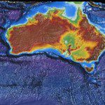
Ocean Exploration: Spatial Challenges in the Sea

China has increased it's pace to pursue ocean exploration, mapping and discovery of natural resources. A new submersible vessel named Jiaolong will explore the Pacific Ocean through a series of deep dives. Beginning at depths of 4,000 meters,...

Thursday, July 14th, 2011

MapmyIndia to Offer Voiced-based GPS Navigators

MapmyIndia, a leading player in maps, GPS navigation and location-based services, has announced a seven-year strategic partnership with Nuance Communications to offer street level turn-by-turn voice navigation on its next-generation navigation devices. For the first time in...

Thursday, July 14th, 2011

OceanWise and Caris Deliver Inaugural ‘Marine SDI’ Mgt Course in Bangkok

The first in a series of courses on the theoretical and practical aspects of hydrographic database design and management to support the development of marine, national and regional spatial data infrastructures (SDI) was delivered successfully from 20...

Tuesday, July 12th, 2011

Azerbaijan Creates e-Services Center in Cadastre

The State Committee for State Property has created an information data base for e-services in the cadastre. The work is carried out within the "Cadastre - Real Estate Registration" project in Ganja and Sheki. At present, the State Committee...

Tuesday, July 12th, 2011

Japanese Citizen Scientists Map Radiation

With the Japanese government only providing spotty information about the radiation leaking from the damaged Fukushima nuclear plant in the early days after the devastating March 11 earthquake and tsunami, a group of tech-minded citizen scientists set...

Tuesday, July 12th, 2011

Australia’s Bligh Reveals 20-Year Infrastructure Plan

Following last year's growth management summit, the State Government this morning released its draft regionalisation strategy. The strategy also includes a 20-year master plan to improve the Bruce Highway. Ms Bligh says the Government's plan focuses on growth in...

Tuesday, July 12th, 2011

Satellites Keep Forest Management in Check

Satellites can bring new transparency to how forests are being managed. With the increasing production of pulp, paper and timber products, there is concern over the effect that expanding plantations and logging in natural forests have on...

Tuesday, July 12th, 2011

ITT Announces Image Analysis Solutions for Industry

ITT Corporation today announced a new initiative to support the integration of its software technology with the ArcGIS platform from Esri. ITT’s new Industry Solutions initiative will take advantage of ENVI tools in ArcGIS to build models...

Page 97 of 178 1 92 93 94 95 96 97 98 99 100 101 102 178