Thursday, August 25th, 2011
The Ministry has recently conducted a digital mapping of coastal areas especially in Gujarat for the purpose of gaining knowledge on resources available, forewarning in case of tsunamis, cyclones etc.Indian National Centre for Ocean Information Services (INCOIS)...

Thursday, August 25th, 2011
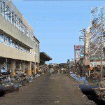
StreetMapper, the vehicle-based laser mapping system, is being used to assess the damage caused by the Japanese earthquake of the 11th March 2011. The mobile mapping system, purchased from Mirukuru and operated by Asia Air Survey, has...
Thursday, August 25th, 2011
Ideal for inside work: the casing in the U-shaped holder can be rotated through 360°. The complete room can be scanned. Self-levelling crossed line laser / 2
Thursday, August 25th, 2011 Mr. M. Shahzad Sarfraz (Malik), PhD student from RSGIS, AIT Thailand attended 2011 ProSPER.NET Young Researchers’ School held in Hosei university Tokyo from 1-12 August under the theme ‘Learning from Japan’s experiences on urban sustainability’ funded by...Congratulations to Mr.Malik for the Research Prize
Thursday, August 25th, 2011
The archipelago of Japan is often struck by natural disasters including earthquakes, floods, and eruptions of volcanoes, which could be disastrous. It is one of important tasks of GSI to provide data for disaster prevention and mitigation...
Thursday, August 25th, 2011
Intermap Technologies a leading provider of location-based information (LBI) solutions created from its uniform, high-resolution 3D digital models of the earth's surface, today announced the appointment of Dr. John C. Curlander to its Board of Directors effective...
Thursday, August 25th, 2011
NEC Corporation announced today the deployment of "myAgri"(1), an SAP enterprise resource planning (ERP) based integrated solution for the agricultural industry. Leveraging the success of myAgri in the United States and South America, NEC will introduce the...

Thursday, August 25th, 2011
The Australian government passed new laws to support carbon farming. The Carbon Farming Initiative is aimed at reducing the loss of carbon from farms and forests. Agricultural production can serve to mitigate the loss of carbon into...
Wednesday, August 24th, 2011
DubaiSat-1, the UAE-owned and operated earth observation satellite, has relayed images of the Holy Cities of Mecca, Medina and Al Quds from outer space. The pan-sharpened, multi-spectral images show the Grand Mosque in Mecca, the Prophet’s Mosque in...
Wednesday, August 24th, 2011
Trimble introduced today the Trimble CCSFlex Compaction Control System for soil and asphalt compactors. The CCSFlex is designed to offer both asphalt and earthmoving contractors an easy-to-use and affordable system for pass count...