Saturday, September 24th, 2011
A five-day training workshop aimed at capacity building and creating awareness among the govt and civil society organisations regarding modern geographic information system (GIS) technologies concluded here on Friday. The workshop was organised by International Union for...
Saturday, September 24th, 2011
The newly developed topographical map will provide details to plan and design the Northern Province, Economic Development Minister Basil Rajapaksa said. He said so after receiving the first batch of the newly developed topographical maps for the Jaffna...
Saturday, September 24th, 2011
MecSoft Europe GmbH announced today that Tinyrobo Co. Ltd , located in Gyeonggi-do, South Korea, will now distribute MecSoft products. “We are pleased that Tinyrobo has made a commitment to providing MecSoft CAM solutions to their users in South...
Saturday, September 24th, 2011
ESA’s Envisat observation satellite yesterday completed its 50 000th circuit of Earth – travelling 2.25 billion km since its launch nearly a decade ago. Envisat orbits our planet every 100 minutes, speeding along at more than seven kilometres...
Friday, September 23rd, 2011
The online submission system for abstracts is now open. The deadline for submission of abstracts of papers for presentation at the ISPRS 2012 Congress is Monday, 24 October 2011. An abstract must be submitted for all papers, including...
Thursday, September 22nd, 2011
Hubei Provincial People's Government Information Office held in Wuhan Hongshan Li Tong the "Eleventh Five-Year" conference. The event was about mapping the development of the province's achievements and important geographic information data. The conference is the Hubei provincial...

Thursday, September 22nd, 2011
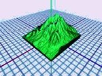
As the world of 3D expands and grows, the role of the printer is adapting to meet the challenge. While most 3D spatial data is usually maintained within a digital environment and managed within software, a 3D...
Thursday, September 22nd, 2011
The UN Food and Agriculture Organization (FAO) is ready to share its experience with Azerbaijan in the use and management of lands, FAO Deputy Director and Regional Representative for Europe and Central Asia Fernanda Guerrieri told reporters...
Thursday, September 22nd, 2011
Natural Power has deployed a dual-mode ZephIR 300 wind lidar with the Centre for Wind Energy Technology (CWET) in Chennai, India. The dual-mode ZephIR can be used in a traditional ground based application pointing vertically for wind...