Author Archive
Tuesday, October 4th, 2011
Russia’s GLONASS satellite navigation system has been upgraded to a precision of up to 5 meters after the successful launch of the 24th GLONASS satellite. The GLONASS-M blasted off the Plesetsk spaceport at 00.15 Moscow time on Monday...
Tuesday, October 4th, 2011
The world economy may be teetering on the brink of a double-dip recession, but business is booming for wireless infrastructure vendors. According to Jake Saunders, vice president of forecasting, "Base station installations in 2011 will total at...
Tuesday, October 4th, 2011
Dubai's Executive Council has approved a 2020 master plan for the emirate, which will demarcate usage of land in the emirate, Emirates 24-7 has reported. "We have to know what we are going to do and what...
Tuesday, October 4th, 2011
The delimitation of state borders of Azerbaijan with Russia and Georgia has been launched in accordance with the relevant decrees issued by the President and Cabinet of Ministers of Azerbaijan. The statement came from Chairman of the State...

Tuesday, October 4th, 2011
GeoMax expands its existing total station portfolio with the Zoom80 Total Station, available as robotic or servo model, to be used easily as a one man total station with up to 1000 meters reflectorless range.

Tuesday, October 4th, 2011
A new member of GeoMax’s complete and...
Saturday, October 1st, 2011
ERDAS proudly announces the release of ECW for ArcGIS Server, version 11.0.2. This product provides a means for ArcGIS Server to deliver data in the ERDAS-patented Enhanced Compression Wavelet (ECW) format to clients via OGC-compliant Web Coverage...
Friday, September 30th, 2011
Tunnel surveyors and geotechnical engineers must seek to minimise underground construction risks and hazards, but are also under immense pressure to keep to tight budgets and schedules. Amberg Geotechnics is the ideal software tool for quickly and...
Friday, September 30th, 2011
Expressions of interest are invited from established suppliers of geographic information wishing to market and distribute marine and coastal data to the engineering, environmental and location based services sectors. The data products comprise raster images of the well-known and popular...
Friday, September 30th, 2011
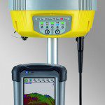
Leica Geosystems announces the new xRTK and SmartRTK for Leica Viva GNSS. Leica xRTK is a new RTK solution that provides maximum availability even in the most difficult conditions. Leica SmartRTK delivers reliable, consistent results in all RTK Networks and...