
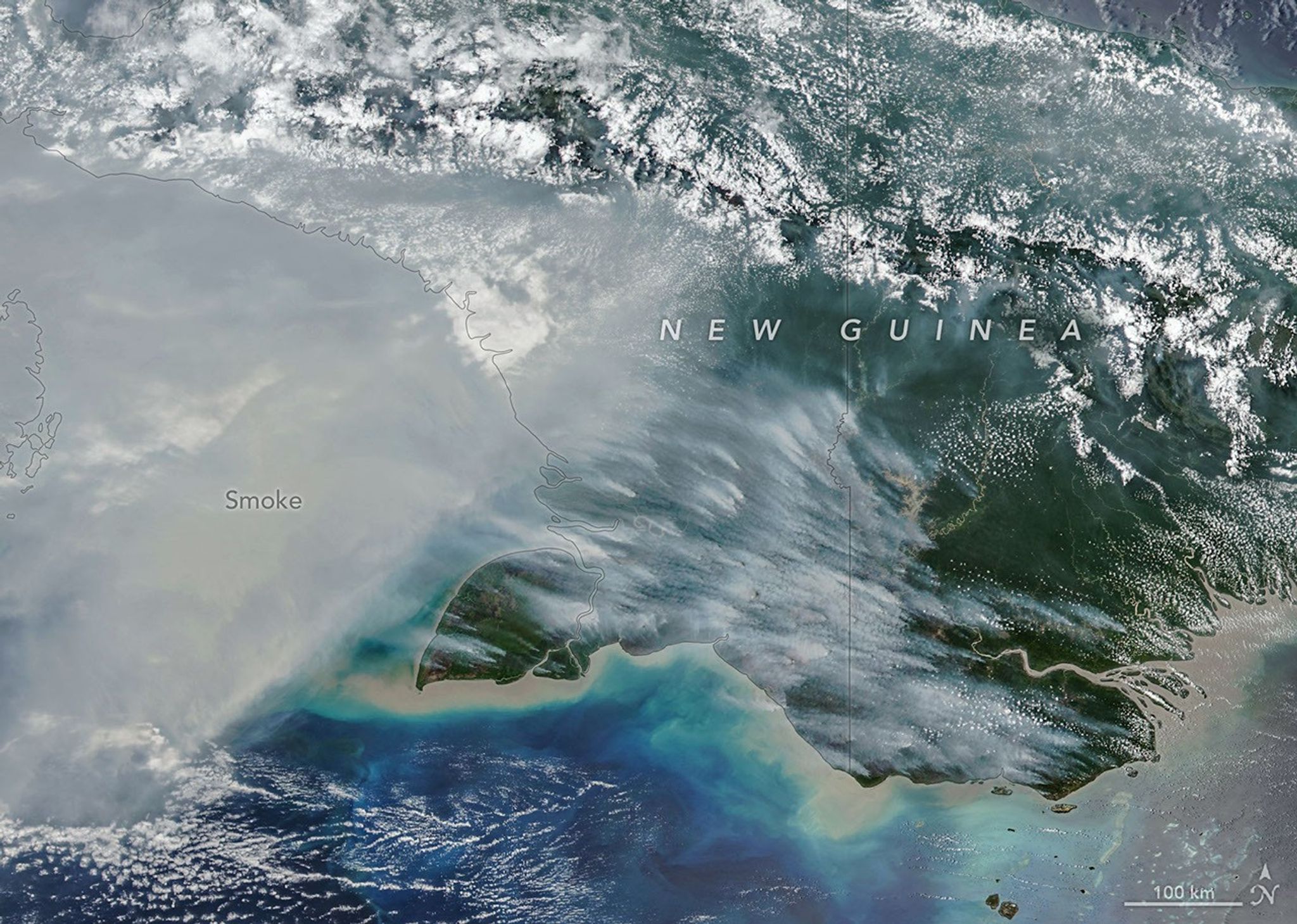
Satellite observations and emissions modeling show an unusually severe 2026 fire season across New Guinea, where drought and widespread burning have produced extensive smoke and exceptionally high carbon emissions. NASA Earth Observatory reported that the Visible Infrared Imaging Radiometer Suite (VIIRS) aboard NOAA-20 captured thick smoke over the southern part of the island on Oct. 11.
According to the satellite-driven Global Fire Emissions Database, fires in Papua New Guinea had released nearly 32 megatons of carbon by Oct. 17—more than in any previous year at the same point in the season. On the Indonesian side of the island, emissions had exceeded 35 megatons, the third-highest comparable total behind 1997 and 2015. These are estimated fire-related carbon emissions, not the number of fires or the area burned.
A strong El Niño contributed to dry conditions across the island. NASA reported that parts of southern Papua New Guinea had gone more than 90 consecutive days without rain, while some areas received only 5 to 10 percent of normal precipitation since August. Many fires begin with land clearing, crop burning or pasture management, but dry vegetation allows some to spread beyond their intended boundaries.
Image Credit: NASA Earth Observatory image by Michala Garrison, using data from NASA EOSDIS LANCE, GIBS/Worldview, Joint Polar Satellite System (JPSS), and the Global Fire Emissions Database (GFED).
