
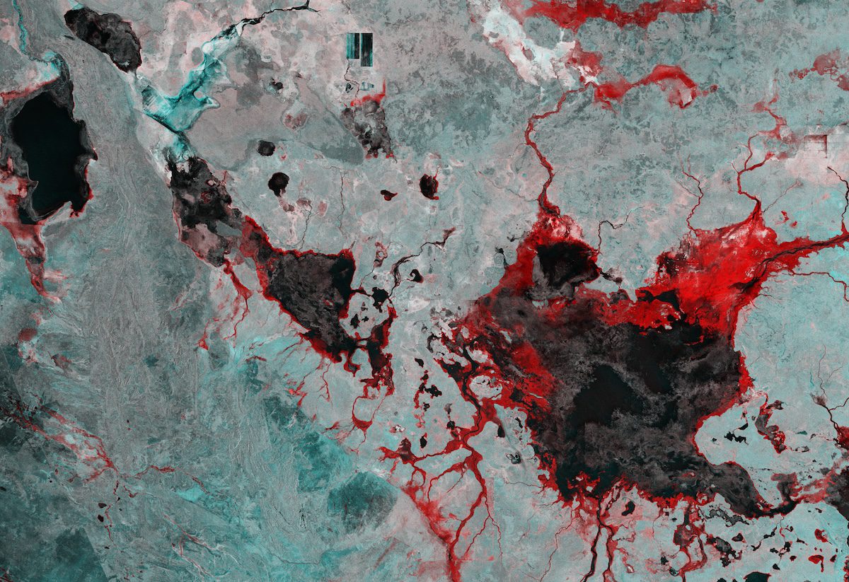
This image captured by the Copernicus Sentinel-1 mission reveals the impact of severe flooding following heavy rain that hit Australia’s Northern Territory in March 2024.
According to the Australian Bureau of Meteorology, March 2024 was the second wettest March on record for the territory, with rainfall far exceeding the average. To make matters worse, tropical cyclone Megan struck the already drenched area, further exacerbating the situation.
This false-color radar image combines data from two acquisitions, one from March 10, 2024, prior to the rainfall, and one from March 22, 2024, after the downpour. Flooded areas are highlighted in red, while dark areas represent permanent water bodies or fields that are frequently submerged.
Tarrabool Lake, the large dark patch in the bottom right, is a seasonal lake whose water level fluctuates. Its swampy wetlands and the nearby tropical forests provide an essential habitat for small mammals, reptiles, and numerous bird species.
Although fed by various creeks, Creswell Creek, flowing down from the northeast, is its main water source and appears to have overflowed, as did most rivers in the area.
Owing to their importance as a breeding site for waterbirds, Tarrabool Lake and the Eva Downs swamp system are listed as an Important Bird Area by BirdLife International, as is Lake Woods, a large ephemeral freshwater wetland, visible as a black patch in the top left corner.
Typically around 350 square kilometers, Lake Woods can expand significantly during periods of seasonal heavy rainfall, supporting up to 116,000 waterbirds when fully inundated.
Image Credit: Contains modified Copernicus Sentinel data (2024), processed by ESA
