Asian Surveying & Mapping
Breaking News
Ecolab and ITE partners to harness water management knowledge for Singapore data center engineers
SINGAPORE, 29 APRIL 2024 – Nalco Water, an Ecolab...
NASA releases satellite photos of Dubai and Abu Dhabi before and after record flooding
NASA released photos of parts of Dubai and Abu...
Singapore releases 10-year Geospatial Master Plan
Singapore has launched its new Geospatial Master Plan (2024–33),...
Japan announces plans to launch upgraded observation satellites on new flagship rocket’s 3rd flight
TOKYO (AP) — Japan’s space agency announced Friday a...
Tesla China partners with Baidu for maps to clear FSD hurdle
Amidst Elon Musk’s unannounced trip to Beijing, China this...
ESA opens ideas factory to boost space innovation in Austria
A centre to innovate the design and manufacture of...
Japan’s space agency sets June 30 as third launch date for H3 rocket
The Japan Aerospace Exploration Agency (JAXA) announced Friday that...
S. Korea launches nanosatellite for Earth observation
SEOUL- A South Korean nanosatellite was launched into orbit...
Australian Space Agency funds development of aerospace-grade GNSS receiver
The Australian Space Agency has funded the development of...
Continuity risks for Australian EO data access
A new report details the widespread use of Earth...
CEODE Deputy Director ZHANG Bing hosts the Opening Ceremony of the 2011 Advanced Hyperspectral Symposium


The event was mainly hosted by the International Society for Digital Earth (ISDE), the Center for Earth Observation and Digital Earth (CEODE) of the Chinese Academy of Sciences (CAS), the Institute of Remote Sensing Applications, CAS, and Beijing Golden Way Scientific Co., Ltd., and co-organized by the Key Laboratory of Digital Earth Science, CAS, and Beijing Golden Way Scientific Co., Ltd.

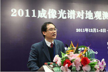
CEODE Deputy Director Zhang Bing hosts the Opening Ceremony of the 2011 Advanced Hyperspectral SymposiumMany presentations were made during the event including  “Hyperspectral Image Classification and Target Detections” by Professor Zhang Bing and included multi-domain applications based on hyperspectral data.

Topics included mineral exploration, inland water color, atmospheric environment exploration, and agriculture, respectively given by Professor Wang Runsheng, Professor LI Yunmei, Professor Chen Liangfu, and Professor Liu Liangyun.

The seminar was also an important platform for exchange and cooperation under the framework of the International Society for Digital Earth. More can be read about the event here.