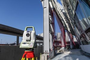
Heerbrugg, Switzerland – Leica Geosystems, part of Hexagon, announced today the new Leica Nova TS60, the world’s most accurate total station, with newly integrated DynamicLock and AutoHeight features.
The new version of theTS60 total station is now equipped with DynamicLock, allowing the instrument to lock onto a moving prism, and devised with AutoHeight, enabling users to get the instrument’s height with a simple button press. With these new integrated capabilities and sub-second and sub-millimetre accuracy, the TS60 is the most accurate total station for minimising risks of downtime and unexpected costs and delays.

Leica Nova TS60 minimises costs and downtime with sub-second and sub-millimetre accuracy, newly integrated DynamicLock and AutoHeight features.
“We use the TS60 primarily when measuring large surveying networks for monitoring dams. Usually, we measure 20-35 points from a station, by conducting at least three sets of measurements in two phases; therefore, we observe each point a minimum of six times. With the new TS60 we achieve highly accurate results and save a lot of time as it is much quicker in navigating to the points than with previously-used instruments,” said Thorsten Zimmer, senior surveyor at Axpo Power AG. “Another good feature of the TS60 is that one can take a picture of the surrounding area with the instrument, including the previously observed points on that picture as an icon. We find this to be a good method of documenting newly observed points.”
The world’s most accurate total station
The TS60 is the only total station in the market that enables users to work with an angular accuracy of 0.5” and a distance accuracy of 0.6mm + 1ppm. Designed and manufactured to the highest levels of quality, this high-end total station is the best fit for most demanding projects due to its reliability even in the harshest conditions.
TS60 users can easily manage, process, analyse and quality check data with the intuitive Leica Captivate onboard software and processes the information back in the office with Leica Infinity survey software. The easy-to-use touch technology and user-friendly apps in the TS60 enable users to perform a variety of surveying tasks.
“We designed the TS60 for highly demanding surveying projects, requiring the world’s highest levels of accuracy and to reliably operate even in the harshest conditions. We integrated new capabilities to help surveyors save time and increase productivity with the fastest re-lock in case of interrupted line of sight – be it rain, fog, dust, sun, heat shimmer or reflections – and automatically measure instrument height,” said Hans-Martin Zogg, business director at Leica Geosystems.
To learn more about the new Leica Nova TS60, please visit: leica-geosystems.com/TS60
Leica Geosystems – when it has to be right
Revolutionising the world of measurement and survey for 200 years, Leica Geosystems, part of Hexagon, creates complete solutions for professionals across the planet. Known for premium products and innovative solution development, professionals in a diverse mix of industries, such as aerospace and defence, safety and security, construction, and manufacturing, trust Leica Geosystems for all their geospatial needs. With precise and accurate instruments, sophisticated software, and trusted services, Leica Geosystems delivers value every day to those shaping the future of our world.
Hexagon is a global leader in sensor, software and autonomous solutions. We are putting data to work to boost efficiency, productivity, and quality across industrial, manufacturing, infrastructure, safety, and mobility applications.
Our technologies are shaping urban and production ecosystems to become increasingly connected and autonomous — ensuring a scalable, sustainable future.
Hexagon (Nasdaq Stockholm: HEXA B) has approximately 21,000 employees in 50 countries and net sales of approximately 3.9bn EUR. Learn more at hexagon.com and follow us @HexagonAB.