Asian Surveying & Mapping
Breaking News
Ecolab and ITE partners to harness water management knowledge for Singapore data center engineers
SINGAPORE, 29 APRIL 2024 – Nalco Water, an Ecolab...
NASA releases satellite photos of Dubai and Abu Dhabi before and after record flooding
NASA released photos of parts of Dubai and Abu...
Singapore releases 10-year Geospatial Master Plan
Singapore has launched its new Geospatial Master Plan (2024–33),...
Japan announces plans to launch upgraded observation satellites on new flagship rocket’s 3rd flight
TOKYO (AP) — Japan’s space agency announced Friday a...
Tesla China partners with Baidu for maps to clear FSD hurdle
Amidst Elon Musk’s unannounced trip to Beijing, China this...
ESA opens ideas factory to boost space innovation in Austria
A centre to innovate the design and manufacture of...
Japan’s space agency sets June 30 as third launch date for H3 rocket
The Japan Aerospace Exploration Agency (JAXA) announced Friday that...
S. Korea launches nanosatellite for Earth observation
SEOUL- A South Korean nanosatellite was launched into orbit...
Australian Space Agency funds development of aerospace-grade GNSS receiver
The Australian Space Agency has funded the development of...
Continuity risks for Australian EO data access
A new report details the widespread use of Earth...

November 13th, 2019
Help map a better future with Pix4D’s Climate Contest

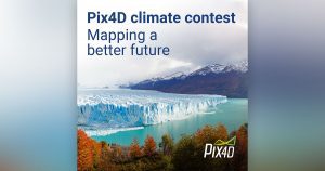
Lausanne, Switzerland: Photogrammetry software company Pix4D has launched its first ever Climate Contest. People from around the world are invited to submit a project which uses mapping to investigate or mitigate the climate crisis for the chance to win up to a $3,000USD cash prize and access to Pix4D software.

From tracking melting glaciers in rural Kyrgyzstan, to counting the cost of storm damaged crops in Puerto Rico, to mapping chimpanzee nests in Tanzania, Pix4D software and #dronesforgood is already helping scientists and citizens prepare to meet the climate crisis. The Pix4D Climate Contest offers changemakers support to get their project off the ground.


  • The Pix4D Climate Contest is now open and is accepting entries until December 13, 2019. Winners will be announced by email in January 2020.
  • Climate change is a global problem, so entries are open worldwide. Any individual, group, business, school or organization can enter and projects don’t need to have started to be considered.
  • The judging panel includes Pix4D GIS-experts, environmental activists and a representative from Swiss Youth for Climate.
  • As well as a cash prize and access to Pix4D software, winners will receive personalised technical support and have their projects featured on pix4d.com.


For more information and to enter: https://www.pix4d.com/climate-contest


About Pix4D

Pix4D (pix4d.com) develops cutting-edge software that converts images taken by hand, by drone, or by plane into accurate and georeferenced survey-grade  2D mosaics, 3D models and point clouds. Founded in 2011, Pix4D is rapidly expanding from its headquarters in Lausanne, Switzerland, to offices in Berlin, Madrid, Denver, San Francisco, Shanghai and Tokyo.