Asian Surveying & Mapping
Breaking News
Australian Space Agency funds development of aerospace-grade GNSS receiver
The Australian Space Agency has funded the development of...
Continuity risks for Australian EO data access
A new report details the widespread use of Earth...
China launches new remote sensing satellite
JIUQUAN, April 15 (Xinhua) -- China on Monday launched...
7.4-Magnitude Earthquake Strikes Taiwan
A major, 7.4-magnitude earthquake struck the eastern coast of...
Tata Deploys Its Geospatial Satellite In Space on Space X’s Falcon 9 Rocket
THIRUVANANTHAPURAM: Tata Company launched India's first private commercial satellite...
Taiwan’s Formosat-8 Satellite Set for Launch by 2025
The Taiwan Space Agency has announced progress on the...
Iranian Scientists to Build Satellite Constellation for 2 Simultaneous Missions
The scientists at the knowledge-based company had previously succeeded...
China provides geospatial intel and other military support to Russia, US says
The US has warned its European allies that China...
Japanese lunar lander company ispace raises $53.5 million in stock sale
WASHINGTON — Japanese lunar lander developer has raised $53.5...
Esri and Prince Sultan University Advance GIS Education Through Strategic Partnership
Memorandum of Understanding with Institution Enhances GIS Curriculum and...

February 1st, 2019
BigData Earth Releases a New Web Mapping, Analysis and Reporting App on Exposure Management

Sydney, Australia – BigData Earth has just released a new web App on location-centric exposure management specific to emergency and insurance applications.

The new App combines web mapping, analysis and reporting together, and takes advantage of the cloud-based big data and analytics platforms and foundational Location Profile APIs (on property location and hazard risk information) the company has built over the past few years. The geographic coverage of the new App includes Australia and the Contiguous US.

The App contains two levels of exposure analyses:
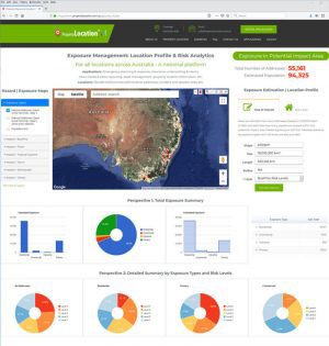
  • Broad-level exposure analysis: For an Area of Interest (AOI), the App can quickly calculate how many addresses and/or estimate how many people are located within potential at-risk areas (Figure 1).

Figure 1

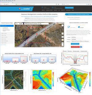
  • Site-level exposure analysis: For an interested site or address, the App produces a wide range of location-specific metrics on the environment and hazard exposure, including elevation, slope, surface water flow directions, vegetation, climate-warming trend, demographics, and housing. Up to 100 metrics, maps and charts are readily generated and reported in seconds (Figure 2).

Figure 2:

The new web App has been hosted by two big data and analytics platforms:

Customization and enhancement of the App is ongoing in response to different geographic coverage, new datasets, client’s requirements and tailored analyses.

BigData Earth ( http://www.bigdataearth.com/) is a data science/technology R&D company creating innovative Location-centric Business Applications worldwide using Geospatial Big Data Analytics, Global Earth Observation and Cloud Computing