Asian Surveying & Mapping
Breaking News
Launch of Australia’s 1st orbital rocket, Gilmour Space’s Eris-1, delayed again
Update for 6:15 p.m. ET on July 1: Gilmour Space...
SAASST, UAE Space Agency strengthen scientific partnership
SHARJAH- Prof. Hamid M.K. Al Naimiy, Director of the...
Shubhanshu Shukla to speak to students and ISRO scientists this Friday
Indian astronaut Shubhanshu Shukla will interact with school students...
ISRO hands over 10 advanced technologies to Indian firms in major push for space commercialisation
The Indian Space Research Organisation (ISRO) has transferred ten...
DIGIPIN Launched: India Embraces Geospatial Precision in Digital Addressing
IIT Hyderabad (IITH), in partnership with the Department of...
HAL to build, market Isro’s SSLV in landmark deal
New Delhi, Jun 20: In a historic move for...
Taiwan developing space capabilities for all-weather imaging
TAIPEI (TVBS News) — Taiwan is advancing its space...
Honda hails successful test of reusable rocket as it looks to get into the space business
Tokyo — Japan's second-biggest carmaker, Honda, has successfully tested...
China’s space program provides larger platform for broader international cooperation
BEIJING -- Experts from China's manned space program said...
India To Launch $1.5 Billion Joint Earth Mission With NASA In July
National Aeronautics and Space Administration (NASA) and the Indian...

water management

Tuesday, May 24th, 2011

Origin Energy Appoints MWH for Water Treatment Services

Consulting engineering firm MWH has been appointed by Origin Energy to provide detailed design services for two proposed water treatment facilities as part of the Australia Pacific LNG (APLNG) project. Origin and ConocoPhillips are joint owners of APLNG, a...

Monday, May 23rd, 2011

Drought Shrinks China’s Largest Lake to Historic Low

Stricken by a severe drought, Poyang Lake, the largest freshwater lake in China, recently began to shrink severely. According to the latest reports from satellite remote sensing, the current water area of Poyang Lake is 1,326 square...

Friday, May 20th, 2011

Bentley Institute Press – New Guide to Water Loss Reduction

Bentley Institute Press, publisher of cutting-edge university textbooks and professional reference works for the architectural, engineering, construction (AEC), geospatial, owner-operator, and educational communities, announced the release of its newest title,Water Loss Reduction.

Friday, May 20th, 2011

Geospatial Technologies of the Mekong River

The Mekong River runs across the Asian continent through one country after another travelling a distance of 4,200 km from beginning to end. The river is managed in a unique way, owing to the Mekong River Commission...

Wednesday, March 2nd, 2011

30 Telemetry Stations in Malaysia for Flood Warning system

The government has set up 30 telemetry stations along the Rajang River to serve as an early flood warning system. The stations will begin from here until Kapit town, a distance of about 126km upriver. Telemetry is...

Thursday, February 24th, 2011

Japanese Space Development Can Benefit the World

Interview with Keiji Tachikawa - President, Japan Aerospace Exploration Agency (JAXA). 2011 began for JAXA with the successful launch of KOUNOTORI 2, a cargo transport vehicle that delivered supplies to the International Space Station. In the spring, astronaut...

Wednesday, February 9th, 2011

Spatial Algorithm for Mapping ET (SAM-ET) for Water Productivity

The Raising National Water Standards project funded by the National  Water Commission aims to develop a spatial algorithm for mapping plant water use (SAM-ET) to quantify multi-scale water productivity which is the most critical information for efficient water...

Monday, February 7th, 2011

GIS Supports Water Harvesting for Fires

Finding itself battling water scarcity instead of reaching an accident site on time, the fire department has finally woken up to city's shrinking waterbodies and the need to look for an alternative rather fast. Desperate, the department...
Sunday, January 30th, 2011

Summary – Japan-Indonesia Workshop on Disaster Management of Water Resources

In these seminars, the Indonesian government under the high interest, and supervision and inspection and supervision of projects bid for contract work related to disaster management of water resources. There has been a lively debate, with further...
Thursday, January 27th, 2011

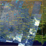
RapidEye Satellites Focus on Loddon Flood Waters, Victoria

The RapidEye constellation of five earth observation satellites have been focused on the East Coast of Australia, dedicating resources to capture valuable images of the ever- changing face of our flooding landscape. The readily enhanced RapidEye satellite...

Page 4 of 5 1 2 3 4 5