Asian Surveying & Mapping
Breaking News
Space42 and ICEYE Announce Joint Venture to Bring Satellite Manufacturing to the UAE
ABU DHABI, UAE —  Space42 (ADX: SPACE42), a UAE-based...
Australia and UK tie up for navigation without GNSS
Airborne navigation without GNSS is the aim of a...
Market size, technical gaps threaten Taiwan’s space dream
As global players like SpaceX dominate headlines, Taiwan is...
China quietly tested its first inflatable space module in orbit
BREMEN, Germany — China tested out a small expandable...
Isro Signs Agreement with Australian Space Agency for Gaganyaan Mission
Isro Signs Agreement with Australian Space Agency for Gaganyaan...
ESA and Japan expand collaboration in space exploration
The European Space Agency (ESA) and the Japan Aerospace...
Korea’s space development to hit wall without private sector initiative
The private sector should take the initiative in South...
India’s Chandrayaan-2 moon orbiter avoids collision with South Korea’s Danuri spacecraft
India's Chandrayaan-2 moon orbiter maneuvered in September to avoid...
Dubai residents may soon have opportunity to travel to the edge of space
Residents of Dubai may soon have the chance to...
Swift Navigation and KDDI Launch Skylark Precise Positioning Service Across Japan
SAN FRANCISCO and TOKYO - Swift Navigation, a global...

terrasar-x

image

Thursday, March 24th, 2011

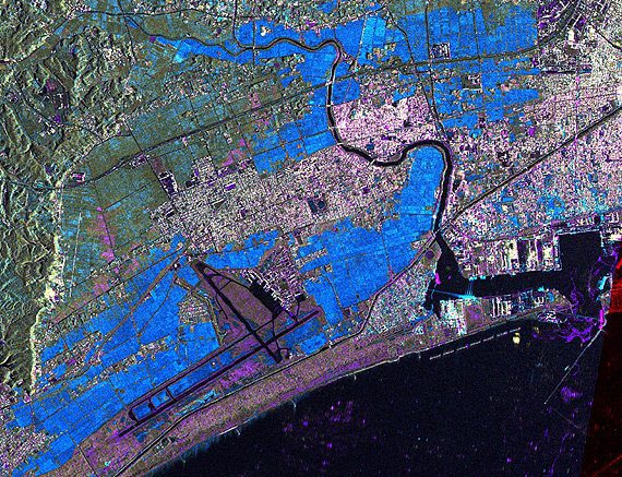
TerraSAR-X Satellite Data Reveals Destruction Caused by Tsunami in Japan

The German Remote Sensing Data Center (Deutsches Fernerkundungsdatenzentrum; DFD) and the German Space Operations Center (GSOC), both of which are part of the German Aerospace Center (Deutsches Zentrum für Luft- und Raumfahrt; DLR), are continuing to provide...
Wednesday, March 16th, 2011

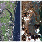
Mapping Japan’s Changed Landscape from Space

The images were acquired by the German Optical RapidEye and radar TerraSAR-X satellites. They show Torinoumi on the eastern coast of Japan before the disaster on 5 September 2010 and after the tsunami on 12 March 2011....