Asian Surveying & Mapping
Breaking News
South Korea partially suspends inter-Korean agreement over North’s spy satellite
SEOUL, South Korea -- South Korea said North Korea fired...
Chinese software firm inks deal with Kenya to boost geospatial technology cooperation
Chinese technology firm, Supermap International, signed an agreement with...
Survey of India, Genesys International Sign MoU to Develop ‘Digital Twins’ Of Indian Cities
Genesys International, India’s home-grown geospatial mapping company and Survey...
UAE Space Agency leads first Space Pavilion participation at COP28
DUBAI - The UAE Space Agency is leading the...
ISRO, NASA likely to launch remote sensing satellite in 1st half of ’24
NEW DELHI: If everything goes as per plan, India...
IBM Advances Geospatial AI to Address Climate Challenges
YORKTOWN HEIGHTS, N.Y.- IBM (NYSE: IBM) today announced new...
Australia Greenlights Game-Changing Era: Commercial Drones with ParaZero Safety Systems to Fly
ParaZero is thrilled to be at the forefront of...
Asia’s top satellite operator aims to launch solar energy forecast system in Europe
Japan’s satellite titan SKY Perfect JSAT aims to expand...
Japan to set up $6.7bn JAXA fund to develop space industry
TOKYO -- Japan's cabinet on Monday approved a bill...
China launches a satellite to compete with Elon Musk’s Starlink
This was stated by Business Insider, citing a report...

river

Friday, December 23rd, 2011

3 Dhaka Rivers to Get Boundary Pillars

Shipping Minister Shahjahan Khan yesterday formally launched the raising of boundary pillars along the Buriganga at Jinjira Ferry Ghat in Keraniganj to demarcate the river and parts of the Turag and the Balu. The High Court in 2009...
Wednesday, November 16th, 2011

New Approaches to Flood Risk Management

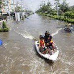
The number and severity of flood events throughout Asia has increased in recent times. Cambodia, Laos, Thailand, Burma and Vietnam have all experienced major flood disasters recently.  Integrated flood management is emerging as a comprehensive approach for...

Friday, May 20th, 2011

Geospatial Technologies of the Mekong River

The Mekong River runs across the Asian continent through one country after another travelling a distance of 4,200 km from beginning to end. The river is managed in a unique way, owing to the Mekong River Commission...