Friday, January 13th, 2012
According to the order issued by President of Azerbaijan Ilham Aliyev, the composition of the national group negotiating the status and lease principles, as well as use of the Gabala radar station (Daryal analytical-information center).
Saturday, December 10th, 2011
The Korea Aerospace Research Institute said that a multi-purpose satellite named Arirang-5 will take off from the Yasny rocket launch site in Russia next year. One of four Korean satellites planned for 2012, the Arirang-5 is the nation's...
Wednesday, September 21st, 2011
A tsunami has been observed with radar for the first time, promising a cheap and more accurate early warning method, according to a study. Researchers have found that the devastating tsunami that hit Japan on 11 March could had been...
Tuesday, September 13th, 2011
JAXA has decided on the logo mark for the dual-frequency precipitation radar (DPR) aboard the main satellite of the Global Precipitation Measurement (GPM) project. As an international program, the GPM project has been led by Japan and the...

Friday, August 19th, 2011
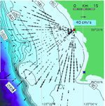
To date, tsunami detection and warning systems have been based on deep-water, pressure-sensor observations that determine changes in sea surface elevation and fluctuation on the coast, which are point measurements. Researchers observed after-the-fact that existing coastal current...
Wednesday, June 1st, 2011
MacDonald, Dettwiler and Associates Ltd. (TSX: MDA), a provider of essential information solutions, announced today that RADARSAT-2 information will be used by the Government of Russia to enhance their ability to provide critical information to support disaster...
Wednesday, May 18th, 2011
Garmin International Inc. announced the GDL 40 – an affordable marine weather solution that brings on-demand graphical weather and radar data directly to a compatible NMEA 2000 Garmin chartplotter. The GDL 40 is the first and only...
Thursday, March 3rd, 2011
A M=6.3 (USGS) earthquake occurred in the South Island of New Zealand on February 21, 2011 (Local Time: 12:51 on February 22). An interferometric analysis of the data acquired by the Phased Array type L-band Synthetic Aperture...
Saturday, January 29th, 2011
ERDAS announces collaboration with MDA Geospatial Services Inc. to develop pilot projects demonstrating real-world applications of RADARSAT-2 data using the IMAGINE Radar Mapping Suite. Radar research and development continues to evolve into real-world applications. It is now...
Sunday, December 12th, 2010
TeraScan version 4.0 brings you all the functionality of version 3.4.1, with additional capabilities such as ingestion of CODAR HF Radar, NEXRAD Doppler radar, and BUFR format files. Support for new satellites and sensors such as COMS,...