Asian Surveying & Mapping
Breaking News
Australian Space Agency funds development of aerospace-grade GNSS receiver
The Australian Space Agency has funded the development of...
Continuity risks for Australian EO data access
A new report details the widespread use of Earth...
China launches new remote sensing satellite
JIUQUAN, April 15 (Xinhua) -- China on Monday launched...
7.4-Magnitude Earthquake Strikes Taiwan
A major, 7.4-magnitude earthquake struck the eastern coast of...
Tata Deploys Its Geospatial Satellite In Space on Space X’s Falcon 9 Rocket
THIRUVANANTHAPURAM: Tata Company launched India's first private commercial satellite...
Taiwan’s Formosat-8 Satellite Set for Launch by 2025
The Taiwan Space Agency has announced progress on the...
Iranian Scientists to Build Satellite Constellation for 2 Simultaneous Missions
The scientists at the knowledge-based company had previously succeeded...
China provides geospatial intel and other military support to Russia, US says
The US has warned its European allies that China...
Japanese lunar lander company ispace raises $53.5 million in stock sale
WASHINGTON — Japanese lunar lander developer has raised $53.5...
Esri and Prince Sultan University Advance GIS Education Through Strategic Partnership
Memorandum of Understanding with Institution Enhances GIS Curriculum and...

openstreetmap

Monday, January 2nd, 2012

Comparing OpenStreetMap with TomTom

As shown earlier the data contributions to OSM show a geographically heterogeneous pattern around the globe. Germany counts as one of the most active countries in OSM; thus, the German street network has undergone an extensive development...

Saturday, March 19th, 2011

Road Status After the Earthquake in Japan Based on OpenStreetMap

A dynamic map overlay showing the Road Status after the Earthquake in Sendai, Japan, based on the user generated maps from OpenStreetMap has been generated by Pascal Neis, member of the GIScience Research Group of the University...

Thursday, December 2nd, 2010

Global Coverage for OGC OpenLS Directory Service

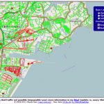
OpenRouteService.org provides a location-based POI search that is implementing the OpenGIS Location Service Directory Specification (OpenLS) already since 2008. This has now been extended from European to Global coverage using the free data from OpenStreetMap. Due to...