Asian Surveying & Mapping
Breaking News
Yanmar, Chia Tai and XAG Empower Thai Agriculture through Innovation
Bang Nam Priao District, Chachoengsao Province, Thailand – On...
bitsensing Signs MOU with IKIO Technologies to Advance AI-Based Traffic Monitoring on India’s Expressways, Highways and Municipal Areas
Backed by proven success in South Korea and Europe,...
Nuri rocket successfully completes KAIST’s next-gen satellite mission
The Korea Advanced Institute of Science and Technology (KAIST)...
President Lai reviews progress on first indigenous satellite constellation
President Lai Ching-te said developing space technology is a...
Japan’s iQPS lines up eight SAR launches
ST. LOUIS — Japan’s Institute for Q-shu Pioneers of...
UAE Astronauts Promote AI and Collaboration in Space at GITEX Europe
The Arab world’s first astronaut, Hazzaa Al Mansouri, and...
New species of space-adapted bacteria discovered on China’s Tiangong space station
Scientists have discovered a previously unknown strain of microbe...
Isro’s 101st mission fails as PSLV-C61 suffers third-stage anomaly
India’s latest Earth observation satellite mission faced a setback...
Iraq’s First Fully Solar-Powered Village in Kulak Is Now Operational
ERBIL, Kurdistan Region – May 20, 2025 — The...
Australia’s Gilmour Space Technologies ready to launch maiden Eris Test flight the nation’s first orbital launch in over 50 years
Gilmour Space Technologies is the leading launch services company...

openstreetmap

Monday, January 2nd, 2012

Comparing OpenStreetMap with TomTom

As shown earlier the data contributions to OSM show a geographically heterogeneous pattern around the globe. Germany counts as one of the most active countries in OSM; thus, the German street network has undergone an extensive development...
Saturday, March 19th, 2011

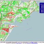
Road Status After the Earthquake in Japan Based on OpenStreetMap

A dynamic map overlay showing the Road Status after the Earthquake in Sendai, Japan, based on the user generated maps from OpenStreetMap has been generated by Pascal Neis, member of the GIScience Research Group of the University...

Thursday, December 2nd, 2010

Global Coverage for OGC OpenLS Directory Service

OpenRouteService.org provides a location-based POI search that is implementing the OpenGIS Location Service Directory Specification (OpenLS) already since 2008. This has now been extended from European to Global coverage using the free data from OpenStreetMap. Due to...