Tuesday, September 6th, 2011
A new release of SectionTools plugin is now available with the latest Rhino 5.0 Beta or later. You can find download links and documentation at SectionTools wiki page.
Thursday, September 1st, 2011
The world’s population is projected to reach approximately 7 billion by 2012. Much of the growth will be in less economically developed countries in central Asia and South America where demands on water resources are already high...
Thursday, August 25th, 2011
The Open Geospatial Consortium (OGC) invites participation in a Hydrologic Forecasting Interoperability Experiment (IE). This activity, which will begin on September 22, 2011, is designed to advance the development of WaterML 2.0 and test its use in...

Thursday, August 11th, 2011
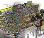
Building Information Modeling (BIM) provides many benefits. An increasing number of projects are now demanding BIM inclusion as the advent of new modeling and design technologies are coupling survey quality data into them, often providing 3D capabilities....
Wednesday, August 10th, 2011
Intergraph has released the newest version of Standard Database for SmartPlant Reference Data, a pre-configured, best-practice solution to enable rapid implementation of SmartPlant 3D and SmartMarine 3D (collectively known as Smart 3D), and materials management. The Standard...
Tuesday, August 9th, 2011
Autodesk, Inc.announced Autodesk Infrastructure Modeler 2012 software for conceptual design and AutoCAD Utility Design 2012 software for electric utility design, two new additions to the Autodesk Building Information Modeling (BIM) for Infrastructure portfolio for planning, designing, building,...
Friday, August 5th, 2011
Esri will exhibit and teach a course about CityEngine, its software for 3D modeling and urban planning, at the SIGGRAPH 2011 conference in Vancouver, Canada, August 7–11. The SIGGRAPH conference is one of the world's...

Monday, July 25th, 2011
Digital terrain models attempt to accurately measure and represent landscape elevation. They can be created using a variety of geomatics technologies including survey equipment, both airborne and space remote sensing, photogrammetry and even manually. These DTMs can...
Monday, June 13th, 2011
The research has been helping China’s disaster management authorities better understand the full impact of the catastrophic flooding that would occur if one of China’s, and the world’s, biggest dams collapsed. The work could also be applied in...

Thursday, June 9th, 2011
If you think location is important and everywhere, then think about measurement. It too is ubiquitous, everywhere and just as important. While satellites continuously circle the planet providing the latest details for highly accurate GNSS positioning, handheld...