Thursday, November 10th, 2011
Intermap Technologies Corporation reported financial results for the third quarter ended September 30, 2011. A conference call will be held today at 4:30 p.m. Eastern Time to discuss the results. The financial information presented herein has been prepared...

Thursday, November 10th, 2011
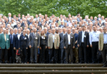
The 53rd Photogrammetric Week was held in Stuttgart, Germany, from 5-9 September 2011 with 380 participants from 45 countries. The conference proved to be a very informative event with developments in new digital aerial cameras, lidar...
Wednesday, November 9th, 2011
The latest version of the World Heritage map, produced by the UNESCO World Heritage Centre and National Geographic Maps, can now be ordered for a modest fee from the World Heritage Centre website. All proceeds from sales...
Wednesday, November 9th, 2011
The joint GSDI 13 World Conference, GEOIDE Annual Scientific Conference and Canadian Geomatics Conference offers numerous opportunities for oral presentations and refereed and non-refereed publication outlets. The joint conference invites presentations covering the full range of practice,...
Wednesday, November 9th, 2011
The Leica GR25 GNSS Reference Server is more than just a reference receiver. With integrated internal and external device management, multi-user management, high end security, modular and scalable design, the GR25 GNSS Reference Server will grow with...
Monday, November 7th, 2011
These satellite photos taken before and after recent floods in Thailand show how the landscape has been transformed. The first slide contrasts two identical areas of Southeast Asia taken on November 12 2008 and November 1 2011. Read...
Friday, November 4th, 2011
Uncovering the origin of illness is like finding a needle in a haystack, but that search is getting easier with the help of powerful tools like genetic analysis and satellite data. Read More
Friday, November 4th, 2011
The book deals with several aspects of soil erosion, focusing on its connection with the agricultural world. Chapters and topics are various, ranging from irrigation practices to soil nutrient, land use changes or tillage methodologies. The book...
Friday, November 4th, 2011
Located in the Province of Macerata, Marche Region (the central part of Italy), Recanati is a famous city with long history and culture development. Under the Municipality of Racanati (Comune di Recanati), the department of Service Planning...