Asian Surveying & Mapping
Breaking News
Australia’s Gilmour Space Technologies ready to launch maiden Eris Test flight the nation’s first orbital launch in over 50 years
Gilmour Space Technologies is the leading launch services company...
Korea’s space agency seeks revision of plan to modify next-gen rockets into reusable system
South Korea's aerospace agency said on Thursday that it...
UAE Space Agency Signs Agreement With Technology Innovation Institute to Execute the Emirates Mission to the Asteroid Belt’s Lander Project
In the presence of His Highness Sheikh Hamdan bin...
Private Japanese lunar lander enters orbit around moon ahead of a June touchdown
A private lunar lander from Japan is now circling the moon, with...
Indian astronaut to travel soon to ISS as part of ISRO-NASA Mission
Prime Minister Narendra Modi said by 2040, an Indian’s...
China issues regulatory framework to support direct-to-device satellite services
HELSINKI — China has released comprehensive regulations for direct-to-device...
Astranis clinches $115 million Taiwan deal despite satellite setback
TAMPA, Fla. — Astranis has signed a $115 million...
UAE and Egypt Strengthen Space Collaboration with New MoU
In a milestone development for Arab space collaboration, the...
Seoul launches 4th spy satellite to boost North Korea surveillance
South Korea’s military now operates an increasingly integrated cluster...
Indonesia seeks space defense cooperation with Japan’s military
Jakarta (ANTARA) - The Ministry of Defense of Indonesia...

laser scanning

image

Thursday, September 10th, 2015

The World of 3D Documentation Through Terrestrial Laser Scanning

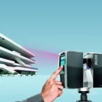
By Mr. Poh Fatt Mak, Business Line Manager (3D Documentation), Asia Pacific, FARO Technologies 3D Documentation is the act of capturing accurate three-dimensional (3D) geometry and images of real objects, reproducible at a certain point in time,...

Thursday, July 9th, 2015

Laser Scanning Captures the Ruins of Japan’s Largest Mountaintop Castle

Researchers at the Archaeological Institute of Kashihara have found some undiscovered remains of Takatori Castle in Nara Prefecture by conducting an airborne laser scanning survey. Working with aerial study firm Asia Air Survey Co. in Tokyo, the...

Tuesday, February 14th, 2012

Motion Pictured: How an Earthquake Warps a Landscape

A team of geologists from the U.S., Mexico and China are using light detection and ranging (LiDAR) laser altimetry to study how an earthquake can change a landscape. In particular, the geologists want to know more about...

Thursday, February 9th, 2012

AeroMetric Acquires Leica Ultra High Point Density LiDAR System

AeroMetric has acquired and installed the new Leica ALS70 - an ultra high point density corridor and wide-area LiDAR system. The model acquired is the ALS70-HP, capable of achieving measurement rates of 500 kHz, and offering unsurpassed control over the...

Tuesday, January 24th, 2012

New Magnasoft 3D Laser Scanning

Magnasoft’s 3D laser scanning division employs the best of the brains in the industry with immense domain knowledge that positions Magnasoft as a leader in 3D Laser scanning services. Laser triangulation is one of the most common techniques...

Wednesday, January 11th, 2012

3D Documentation of Niah Caves, Sarawak

A warm, humid Monday morning marked the beginning of an expedition to the Niah Caves, located in Sarawak, East Malaysia. Involving academics from several institutes of higher learning, hailing from three different continents, this study trip was...

Wednesday, December 14th, 2011

Next Generation Focus3D Laser Scanner

FARO announces new state-of-the-art 3D Documentation technology. New Multi-Sensor hardware feature includes the Compass and Height Sensor which complement the existing Dual Axis Compensator for the FARO Focus3D. The two new sensors deliver the orientation and the...

Thursday, November 10th, 2011

SCENE WebShare Software V4.9 for Direct 3D Measurements on the Web

FARO announces the availability of the new version of SCENE WebShare, its powerful tool for easy and safe sharing of scan data over the Internet.

Thursday, November 10th, 2011

Focus3D Laser Scanner Introduced

New Multi-Sensor hardware feature includes the Compass and Height Sensor which complement the existing Dual Axis Compensator for the FARO Focus-3D. The two new sensors deliver the orientation and the relative height against a set starting point...

Tuesday, November 8th, 2011

Leica Cyclone v7.3.2 Features Support for New ASTM E57 Industry Standard

Leica Geosystems announces Leica Cyclone v7.3.2 that fully supports the recently released ASTM E57 standard for 3D Imaging data exchange, which includes 3D laser scanning systems. This capability facilitates direct import and export of laser scan “as-built”...

Page 1 of 3 1 2 3