Thursday, August 4th, 2016
Diwata-1, the country’s first microsatellite, has captured images of some portions of Dumingag town in Zamboanga del Sur, a mountainous area in Mindanao, an attached agency of the Department of Science and Technology shared. Read More at...
Thursday, March 29th, 2012
An NGO in India has started to use Google Earth satellite technology to shine a light on whole neighborhoods of wretched slums, which authorities had long pretended didn't even exist. But not all are happy about what...
Thursday, March 15th, 2012
SimActive Inc., a world-leading developer of photogrammetry software, is pleased to announce release 4.0 of its Correlator3D product capable of producing dense digital surface models (DSM). Building on the success of its previous DSM module, this new release leaps ahead...
Wednesday, March 14th, 2012
In the EORSA 2012, there will be a lot more technical sessions, and great possibility to meet with fellow researchers from all over the world and to connect with new people / research teams. So, be prepared...
Tuesday, March 6th, 2012
Based on common web technologies including HTML, CSS and JavaScript, the ARchitect Engine puts the power of Augmented Reality directly in the hands of the developers with multimedia support and advanced interaction possibilities.
Monday, March 5th, 2012
Astrium Services’ GEO-Information team has now taken satellite-based monitoring to a new level. Based on cutting-edge satellite imagery, standard and advanced image analysis, processing and interpretation, the new service Go Monitor provides high-quality change information for any...

Thursday, March 1st, 2012
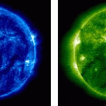
Solar flares and other space phenomenon can quickly impact communications, electronic systems and GNSS operations on earth. The South Korean government has initiated a new space weather system that will provide up-to-date information about space weather for...
Wednesday, February 29th, 2012
Earth observation is the science of modeling and monitoring of the processes on the surface of the planet and their interaction with the Earth’s atmosphere. The planet is constantly monitored using state-of-the-art radar and optical sensors. The...
Friday, February 17th, 2012
Z/I Imaging is pleased to announce the release of its Z/I Software version 6.4. Z/I Sensor Software includes a suite of products for the DMC and DMC II camera families for raw image data post processing, distributed...
Thursday, February 2nd, 2012
Do you need to manage LIDAR and raster data, but have concerns about handling massive amounts of image files and LIDAR point cloud data? Solving the issue of scattered, underutilized and redundant data, ERDAS APOLLO enables you to...