Friday, September 23rd, 2011
The online submission system for abstracts is now open. The deadline for submission of abstracts of papers for presentation at the ISPRS 2012 Congress is Monday, 24 October 2011. An abstract must be submitted for all papers, including...

Thursday, September 15th, 2011
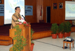
In Indonesia the signing of a Memorandum of Understanding between the Coordinating Agency for Surveys and Mapping Agency (RAN) with the National Archives of the Republic of Indonesia (ANRI) took place this week. The scope of this cooperation...
Tuesday, August 30th, 2011
In a major breakthrough to enhance the Sultanate’s preparedness against a possible tsunami, a scientist at the Sultan Qaboos University (SQU) has suggested a hazard map for the country to be well-equipped. Learning from the best practices...
Tuesday, August 23rd, 2011
SuperGeo Technologies announces that SuperPad 3 is going to support to display the cached images generated by SuperGIS Map Tile Tool. SuperPad 3, the full-function mobile GIS software mainly designed for mobile GIS and outdoor mapping, can assist...
Tuesday, August 23rd, 2011
Working with their own software provides the ability to develop and customize tools specifically to their customer’s requirements, adjusting them to each project’s specifications. Additionally, Dielmo is continuously developing new functionalities to address any problems that may arise when generating...
Tuesday, August 23rd, 2011
The Emergency Services Telecommunications Authority (ESTA)has joined the push for a uniform national standard that requires land developers to provide Councils with digital data showing the accurate ‘as constructed’ location and details of all council assets such...
Monday, August 8th, 2011
The A-SPEC group was formed to streamline the processes undertaken to display new assets within each member’s GIS and Asset Management Systems.A common specification for the supply of digital data was identified as a major opportunity for the consortia members to...
Thursday, August 4th, 2011
Orbit GeoSpatial Technologies is proud to announce the launch of Orbit GIS X, the new generation desktop GIS. Orbit GT today announces the availability of Orbit GIS X. Totally reworked, Orbit GIS X is the new engine for...
Thursday, July 28th, 2011
The GEO-Information division of Astrium Services is pleased to announce the launch of anew comprehensive offer of elevation data: the GEO Elevation product suite. These elevation models are used for high-quality image orthorectification, multi-scale mapping, terrain knowledge,...
Monday, July 25th, 2011
Thailand ranked the worst in disaster recovery readiness among eight countries in Asia-Pacific, defying the trend toward increasing use of cloud-based backup and disaster recovery programmes in the region, according to a survey. Conducted by the independent...