Asian Surveying & Mapping
Breaking News
China Launches Earth Observation Satellite Gaofen-13 02 for Remote Sensing
China on Friday sent a new Earth observation satellite...
ISRO to conduct young scientist programme in Bengaluru
The Indian Space Research Organisation (ISRO) is organising a...
Egypt launches second remote-sensing satellite from China
The Egyptian Space Agency’s CEO, Sherif Sedky, announced the...
Israeli-developed DRONE DOME to secure Dubai from aerial attacks
Rafael Advanced Defense Systems Ltd. is supplying the system...
China launches 2nd Horus remote-sensing satellite for Egypt (video)
China has launched a second remote-sensing satellite for Egypt,...
China obstructs new subsea cable to Taiwan
Southeast Asia-Japan Cable 2 connecting Japan, Taiwan, Hong Kong,...
Scientific collaboration between China and US key to tackling climate change, experts say
Efforts to combat climate change bore the brunt of...
ISRO Receives India-US Jointly Built NISAR Earth Observation Satellite, Begins Preparations For Launch
US space agency NASA has handed over NISAR earth...
ISRO conducts parachute deployment tests on rail tracks for Gaganyaan Mission
Indian Space Research Organisation (ISRO) has conducted Rail Track...
OceanX helps Riyadh boost best up-and-comers in GEOINT
The Saudi Space Commission has given OceanX the difficult...

forecasting

Thursday, November 14th, 2013

German Aerospace Center Deploys Scality RING To Power Mission-critical Environmental Analysis of High Resolution Earth Images

DLR / German Aerospace Center, has selected Scality’s award winning Scality RING petabyte scale storage solution to host its active archive for large amounts of their high definition satellite images. DLR’s Earth Observation Center uses remote sensing...

Thursday, October 17th, 2013

India Credits Satellite Sentinels for Saving Lives

India was hit hard by Cyclone Phailin, with 12 million people impacted, including millions evacuated from the Odisha coast to safety earlier this week. This was the strongest storm to hit the state in 14 years, and...

Tuesday, April 24th, 2012

National Crop Forecast Centre in India to Make Its Maiden Forecast

Sharad Pawar, minister of agriculture and food processing industries, today inaugurated the National Crop Forecast Centre in New Delhi today. The NCFC, named after statistician P C Mahalanobis, has been set up in collaboration with Indian Space...

Thursday, March 1st, 2012

South Korea Launches Space Weather Services

Solar flares and other space phenomenon can quickly impact communications, electronic systems and GNSS operations on earth. The South Korean government has initiated a new space weather system that will provide up-to-date information about space weather for...

Monday, January 23rd, 2012

The BLUElink Project

The Australian Government, through the Commonwealth Bureau of Meteorology, Royal Australian Navy and CSIRO has initiated BLUElink Ocean forecasting Australia, a $15m project to deliver ocean forecasts for the Australian region. Read More
Thursday, December 22nd, 2011

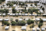
Data Intelligence: The Australian Flood Prevention Wall

Last year saw extensive flood damage throughout the Brisbane, Australia area. Damage estimates were in the billions of dollars. Infrastructure was destroyed, crops were submerged and the energy industry was impacted significantly. The toll on human life...

Tuesday, October 11th, 2011

Viet Nam’s Fishing Forecasts Inaccurate – and late

Viet Nam's fisheries forecasting was both inadequate and inaccurate, heard a meeting organised by the General Fisheries Department earlier this week. Information provided quarterly by the Fisheries Research Institute to help fishermen know where, what and how much...

Tuesday, October 4th, 2011

2011 Base Station Shipments Will Be Up 14%

The world economy may be teetering on the brink of a double-dip recession, but business is booming for wireless infrastructure vendors. According to Jake Saunders, vice president of forecasting, "Base station installations in 2011 will total at...

Sunday, July 17th, 2011

Bangalore Meteorological Center Improves Weather Mapping

In an effort to improve and enhance weather mapping capabilities, Bangalore Meteorological Centre, India Meteorological Department (IMD), under its modernisation project is installing about 100 Automatic Rain Gauges (ARG) and two Doppler Weather Radars (DWR) across the...

Wednesday, January 26th, 2011

US to Provide Detailed Monsoon Data this Year

Removal of Indian scientific and defense institutions such as ISRO and DRDO from the US Entity list this week could result in some unexpected riches raining on India. The immediate fall-out of the thaw between the non-proliferation...

Page 1 of 2 1 2