Monday, February 7th, 2011
AAM, as distributors or Geocortex in Australia, are pleased to announce that Latititude Geographics have just released their Geocortex Essentials 3.3 software. This latest release of...
Monday, February 7th, 2011
Geoimage is thrilled to have won DigitalGlobe’s prestigious Platinum Reseller award for our work during 2010.The award was presented during DigitalGlobe’s South Asia Reseller 2011 Kick-Off Meeting last week in Phuket, Thailand. The award is...

Thursday, January 27th, 2011
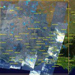
The RapidEye constellation of five earth observation satellites have been focused on the East Coast of Australia, dedicating resources to capture valuable images of the ever- changing face of our flooding landscape. The readily enhanced RapidEye satellite...
Tuesday, January 18th, 2011
This map uses trend analysis to visualize community reports related to the flooding in Queensland. The Ushahidi social network allows anyone to report incidents via SMS, e-mail or the web. You can view all categories to understand...
Saturday, January 15th, 2011
Since December 2010, floods have been hitting Australia, particularly in Queensland. A new map application is now available to provide updated information. It shows the scope of flood response, including evacuation centers and accessible roads near Brisbane,...
Thursday, January 13th, 2011
Share your knowledge, experience and vision with over 1000 delegates by presenting a paper at the ISDE7, WALIS Forum 2011 and the State NRM Conference. We are now inviting submissions of abstracts for both oral and poster presentations....

Saturday, October 30th, 2010
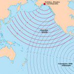
During the past week we have learned that the existing Tsunami Warning Systems in Indonesia have been vandalised. This act may have contributed toward the greater number of deaths as, any...

Tuesday, August 31st, 2010
At last week’s GITA conference in Brisbane Australia John Culleton, CEO of the Colleambally irrigation area set about busting some commonly held myths about irrigation. Colleambally irrigates 300,000 hectares in Australia’s Murray Darling Basin where farmers grow...
Friday, August 6th, 2010
An international consortium* led by the University of NSW plans to begin designing satellite 3D mapping from space that could help monitor disasters like floods and fires. The 3-year project just...
Thursday, July 16th, 2009
A new milestone has been reached: this month the Western Australian archive of RapidEye satellite imagery has surpassed 1.75 million sq km. Satellite imagery coverage over Western Australia has increased significantly in the past four months. Almost...