
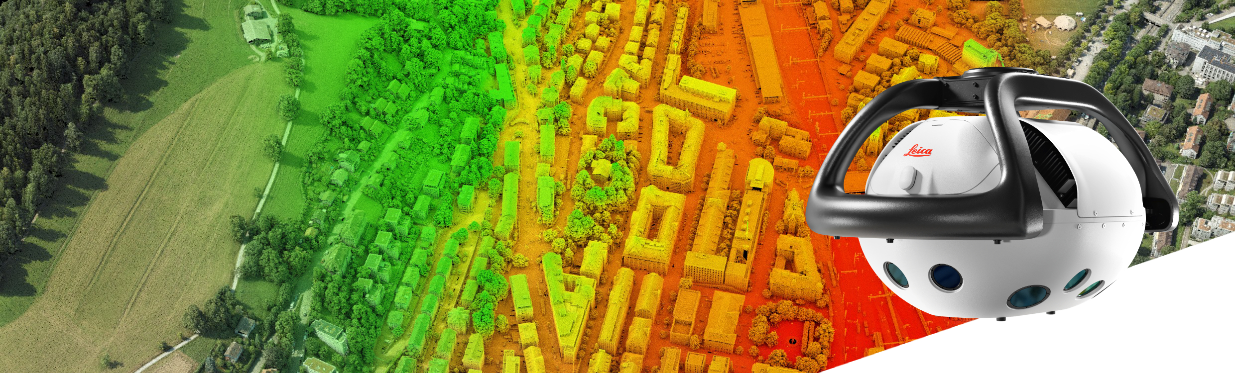
(Heerbrugg, Switzerland, 16 February 2026) Leica Geosystems, part of Hexagon, today introduced the Leica MultiMapper, a new compact hybrid airborne system combining imaging and LiDAR in one easy-to-deploy solution. Designed to fit all helicopter sizes and light fixed-wing aircraft, the system delivers efficient, high-performance data capture across multiple mapping applications.
Built for rapid mobilisation and operational flexibility
Weighing less than 25 kilogrammes, the MultiMapper is easy to handle, transport, and install. It enables pilot-only operations and reduces operational complexity. Its lightweight design supports rapid mobilisation, allowing deployment, flight, and demobilisation within a single day. This flexibility lets organisations respond quickly to diverse mission requirements, including operations in hard-to-reach areas and challenging environments.
High-performance hybrid data capture
Built on Leica Geosystems’ long-standing expertise in airborne hybrid data collection, MultiMapper integrates a multi-view nadir and oblique camera with a high-density LiDAR in one single platform. This configuration enables the simultaneous collection of imagery and LiDAR data, seamlessly supporting applications ranging from city modelling and corridor mapping to infrastructure inspection, and post-event assessment.
End-to-end mapping workflows for efficient data delivery
The MultiMapper is fully supported by Leica Geosystems’ streamlined workflow suite. The new Leica AirPro FIELD app provides a tablet-based interface that allows the operator to control sensors in-flight, manage mission settings, and review flight parameters on the go, ensuring confidence in the data and efficiency throughout the mission.
“Leica MultiMapper builds on a decade of leadership in hybrid imaging and LiDAR technology, re-engineered into a compact, highly portable format,” said Werner Kirchhofer, VP of Product Development at Leica Geosystems, Scanning & Mapping Division. “More than a new system, MultiMapper marks a shift in how airborne mapping can be deployed and scaled. By enabling faster, more agile execution across diverse mission profiles, it opens the door for new users while empowering existing customers to expand their capabilities and service portfolios.”
For more information, visit: https://leica-geosystems.com/products/airborne-systems/hybrid-sensors/leica-multimapper
For further information, please contact:
Cristina Mauri, Product Marketing Manager, Airborne Sensors, Scanning & Mapping Division, Hexagon
Phone: +41 76 407 62 17
Email: [email protected]
Leica Geosystems – when it has to be right
With more than 200 years of history, Leica Geosystems, part of Hexagon, is the trusted supplier of premium sensors, software, and services. Delivering value every day to professionals in surveying, construction, infrastructure, mining, mapping and other geospatial content-dependent industries, Leica Geosystems leads the industry with innovative solutions to empower our autonomous future.
Hexagon is the global leader in measurement technologies. We provide the confidence that vital industries rely on to build, navigate, and innovate. From microns to Mars, our solutions ensure productivity, quality, and sustainability in everything from manufacturing and construction to mining and autonomous systems.
Hexagon (Nasdaq Stockholm: HEXA B) has approximately 24,800 employees in 50 countries and net sales of approximately 5.4bn EUR. Learn more at hexagon.com.
