
Lausanne, Oct 7, 2025
PIX4Dcatch is a user-friendly 3D scanning and AR visualization tool used by professionals in industries such as underground utility mapping and construction. Paired with the Trimble® Catalyst™ DA2 positioning system, this comprehensive solution combines photogrammetry, LiDAR technology, and RTK positioning to deliver centimeter accuracy, making it a value-added tool for high-quality data capture.
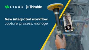
This combination forms the foundation of a new integrated workflow, bringing together field capture, cloud processing, and long-term data management. PIX4Dcatch with the Trimble DA2 GNSS receiver captures georeferenced 3D data in the field. The data is then processed and managed within PIX4Dcloud, providing access to 2D maps and 3D models. These assets integrate into Trimble Connect®, a common data environment and collaboration platform.
“At Pix4D, we’re committed to simplifying complex geospatial workflows,” said Andrey Kleymenov, CEO of Pix4D. “This integration within the Trimble ecosystem, from PIX4Dcatch with DA2’s high accuracy positioning to Trimble Connect, enables professionals to collect and manage 3D data with precision and ease, supporting true end-to-end workflows from field capture to final project insight.”
“Expanding the Trimble technology ecosystem with Pix4D helps our customers streamline the workflow for capturing and sharing reality capture data with project stakeholders,” stated Tim Lemmon, Senior Marketing Director, Geospatial at Trimble. “Better understanding of the site enables more informed decision making, increasing productivity to deliver reliable outcomes.”
About Pix4D: Pix4D products are developed in Lausanne, Switzerland. Pix4D has five additional offices in the USA, Germany, Spain, Romania, and Japan. The company develops end-to-end mapping solutions that convert images into survey-grade georeferenced maps, models, and other business-critical insights using advanced algorithms based on computer vision, photogrammetry, and machine learning.
