
Faster Overall Workflow
AARSCHOT, Belgium – Virtual Surveyor has enhanced its popular smart drone surveying software with new planimetric survey capabilities. In addition to multiple performance modifications, Virtual Surveyor version 9.5 now enables users to quickly, easily, and accurately survey 2D features from drone orthophotos and add them to the 3D topographic model generated from the same data set.
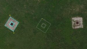
Duplicating a manhole drawing with the Move/Copy tool.
“The new planimetric tools significantly improve the speed with which users can survey the features that reside on top of the topography,” said Tom Op ‘t Eyndt, Virtual Surveyor CEO. “These include features that truly exist in 2D on the terrain, as well as 3D objects that can be represented in 2D for the purposes of the survey.”
True 2D features, for example, include the paint striping that delineates parking lot spaces and road lanes. Other objects that exist in 3D on the ground but can be surveyed in two dimensions for many applications are building footprints and tree canopies. The addition of these features brings a new level of efficiency to the drone surveying process in Virtual Surveyor.
Virtual Surveyor provides users an end-to-end workflow to conduct 3D surveys from drone imagery. The integrated Terrain Creator app photogrammetrically processes drone photos to build survey-grade digital surface models (DSMs) and orthomosaics. These transfer seamlessly to the traditional Virtual Surveyor app where users perform the real survey work – generating CAD models, creating cut-and-fill maps, calculating soil volumes, and deriving other 3D topographic information.
No third-party software is needed to create surveys from drone data for use by engineers in construction, surface mining, and excavation projects.
New planimetric functionality in Virtual Surveyor complements existing point-and-click drawing tools (Point, Polyline, Arc, Circle, Rectangle, etc.) for delineating surface features in the 2D View mode, dramatically accelerating this surveying process. These new functions include –
In addition to Planimetric Survey functionality, Virtual Surveyor has made these important upgrades in Version 9.5:
Current subscribers to Virtual Surveyor Ridge and Peak editions will see their software updated automatically to Version 9.5 with the planimetric tools and other new functionality.
To start a free 14-day trial of Virtual Surveyor and to view details of the Valley, Ridge, and Peak pricing plans, visit www.virtual-surveyor.com.
About Virtual Surveyor
Virtual Surveyor software enables professional surveyors to generate accurate topographic end products from drone photos five times faster than traditional field work in a seamless fully integrated workflow. Now used in 88 countries, Virtual Surveyor creates topographic information from drone data in very short timeframes. In a typical application, the suite generates an orthomosaic and digital surface model (DSM) from UAV imagery and then transfers the survey-grade terrain products to an interactive virtual environment onscreen where surveyors can select the survey points and breaklines that define topography. Standard topographic outputs from the Virtual Surveyor software are Surfaces or TINs (Triangular Irregular Network), Contours, Line Surveys, Stockpile Reports and Cut-and-Fill Maps for use in a variety of engineering design applications.
