
Bringing unprecedented efficiency and data quality to large-area aerial data collection
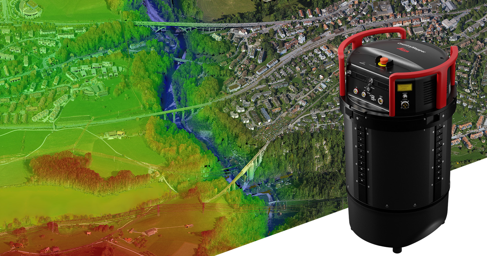
(Heerbrugg, Switzerland) Leica Geosystems, part of Hexagon, introduces the Leica CountryMapper, extending the hybrid sensor portfolio with the most efficient solution for large-area imaging and LiDAR mapping. Combining a large-format photogrammetric camera with a high-performance LiDAR unit into a single system, the CountryMapper collects foundational geospatial data simultaneously, enabling the generation of highly accurate data products to support a wide variety of customer applications.
The CountryMapper makes full use of Leica Geosystems’ unique expertise in combining industry-leading imaging and LiDAR sensor modules into highly efficient hybrid airborne systems. CMOS-based Leica MFC150 camera modules leverage true mechanical forward-motion-compensation (FMC) to deliver industry-leading image quality, even at faster aircraft speeds and in challenging lighting conditions. The new Hyperion3 LiDAR unit features 60 degrees field of view, improving the performance and flexibility of the system compared to previous LiDAR modules, while reduced laser divergence provides greater planimetric accuracy and better foliage penetration. The CountryMapper fully integrates with Leica HxMap multi-sensor end-to-end processing workflow, enabling distributed processing of images and point clouds to optimise productivity for very large data sets.
Setting new productivity standards in the airborne mapping industry
The imaging and LiDAR systems cover the same swath simultaneously, ensuring maximum temporal and geometric data consistency. The hybrid system maximises accuracy of the collected data and enables the generation of the most comprehensive 2D and 3D products, supporting applications such as orthophoto generation, terrain mapping, hydrography, forestry monitoring and infrastructure management. Eliminating the need to fly two separate imaging and LiDAR systems, the CountryMapper collects more data in fewer flying hours, significantly reducing operational costs and environmental impact. Owners of previous-generation sensors can leverage their initial investment and upgrade their systems to the CountryMapper configuration.
“Airborne data providers have had to tailor their LiDAR and imaging offerings to emphasise one or the other. The CountryMapper provides both at the highest performance levels in a single system configuration,” said Layton Hobbs, Airborne Product Line Director at Hexagon. “With its unmatched efficiency, data accuracy, and application versatility, the new sensor is set to transform large-area mapping projects. Building on our success with the Leica CityMapper, the CountryMapper continues to push the boundaries of hybrid airborne mapping, empowering customers with a highly productive and versatile solution that redefines our industry standards.”
To learn more about the Leica CountryMapper and its capabilities, please visit the Leica Geosystems website.
Leica Geosystems – when it has to be right
With more than 200 years of history, Leica Geosystems, part of Hexagon, is the trusted supplier of premium sensors, software and services. Delivering value every day to professionals in surveying, construction, infrastructure, mining, mapping and other geospatial content-dependent industries, Leica Geosystems leads the industry with innovative solutions to empower our autonomous future.
Hexagon (Nasdaq Stockholm: HEXA B) has approximately 24,000 employees in 50 countries and net sales of approximately 5.2bn EUR. Learn more at hexagon.com and follow us @HexagonAB.
