Vaughan, Ontario, CANADA – April 13, 2023 – Teledyne Geospatial will bring its latest advancements in ocean mapping hardware and software solutions to Ocean Business 2023, being held at the National Oceanography Centre, Southampton, UK from April 18-20.
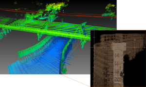
Visitors to the Teledyne Geospatial booth U12 will be introduced to the CL-360 for marine applications, a lidar sensor that can be seamlessly integrated with high resolution multibeam systems and the CARIS Ping-To-Chart workflow, allowing for full above and below water image capture with survey grade accuracy in a single workflow. The sensor’s 360-degree scanner and up to 2 million points/second collection rate provides a premier solution for mapping coastal infrastructure. The CL-360 is the only lidar system designed for use on a USV (uncrewed surface vessel) which provides survey grade range and accuracy.
Find out about the new HIPS & SIPS 11.4 release, now with sound speed and vertical correction mode available for the first time as a SaaS licensing option. Learn about the CZMIL Super Nova, the world’s most advanced lidar bathymeter with the highest green laser point density in its class and real-time processing capability for reduced post-processing time.
At Teledyne Marine’s Hospitality and Demo Suite you are invited to experience live dockside workshops demonstrating a concept of pushing data straight from Teledyne Marine sonars to the Teledyne CARIS Cloud where CARIS Onboard runs the data through an automated processing routine and makes the products available for stakeholders to monitor progress. This also allows remote data processors to immediately access data without needing to be in the field.
Teledyne Presentations at Ocean Business include:
Tuesday April 18th, 2:30 – 3:30, Access Grid Classroom 124/14:
“Latest Updates in the CARIS Ping to ChartTM Workflow”: Come and see the latest from the CARIS Cloud and new and upcoming features for HIPS and SIPS.
Presenter: Travis Hamilton
Wednesday April 19th, 11:30 – 12:30, Access Grid Classroom 124/14:
“How & Why: An Introduction to Marine Laser Scanning”: Learn about the functionality and efficiency of adding a laser scanner to marine survey. Get an introduction to the industry’s latest and most productive laser scanners the Optech TLS-M3 and the brand-new CL-360 for marine.
Presenter: Travis Hamilton
Stop by booth U12 to attend our planned demos and a chance to win a drone. Our experts will be at hand to discuss our valuable show special promotions including CARIS Collect, Mira AI and CARIS Onboard.
Teledyne Geospatial unifies the hardware and software expertise of both Teledyne CARIS and Teledyne Optech. The new group provides customers with innovative integrated solutions. Offerings include turnkey systems, lidar and sonar integrated workflows and a range of systems and solutions that support holistic, precision data collection.
