Asian Surveying & Mapping
Breaking News
Iraq’s First Fully Solar-Powered Village in Kulak Is Now Operational
ERBIL, Kurdistan Region – May 20, 2025 — The...
Australia’s Gilmour Space Technologies ready to launch maiden Eris Test flight the nation’s first orbital launch in over 50 years
Gilmour Space Technologies is the leading launch services company...
Korea’s space agency seeks revision of plan to modify next-gen rockets into reusable system
South Korea's aerospace agency said on Thursday that it...
UAE Space Agency Signs Agreement With Technology Innovation Institute to Execute the Emirates Mission to the Asteroid Belt’s Lander Project
In the presence of His Highness Sheikh Hamdan bin...
Private Japanese lunar lander enters orbit around moon ahead of a June touchdown
A private lunar lander from Japan is now circling the moon, with...
Indian astronaut to travel soon to ISS as part of ISRO-NASA Mission
Prime Minister Narendra Modi said by 2040, an Indian’s...
China issues regulatory framework to support direct-to-device satellite services
HELSINKI — China has released comprehensive regulations for direct-to-device...
Astranis clinches $115 million Taiwan deal despite satellite setback
TAMPA, Fla. — Astranis has signed a $115 million...
UAE and Egypt Strengthen Space Collaboration with New MoU
In a milestone development for Arab space collaboration, the...
Seoul launches 4th spy satellite to boost North Korea surveillance
South Korea’s military now operates an increasingly integrated cluster...

April 11th, 2023
GeoAlert releases new region-specific Building footprints AI models.

GeoAlert has released new region-specific Building footprints AI models and unified them under the single Buildings pipeline. Currently, there are 3 global regions and 3 corresponding Building segmentation models, which will be further improved. Launching the processing, the actual regional model is selected based on user area of interest and are now available at both Mapflow Web and Mapflow QGIS plugin.

Geoalert is an international startup that develops an AI-powered SaaS platform called Mapflow.ai and promotes streaming services for Earth observation data.

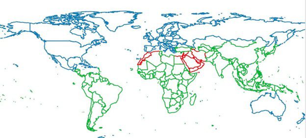
Three global Buildings AI footprint models  


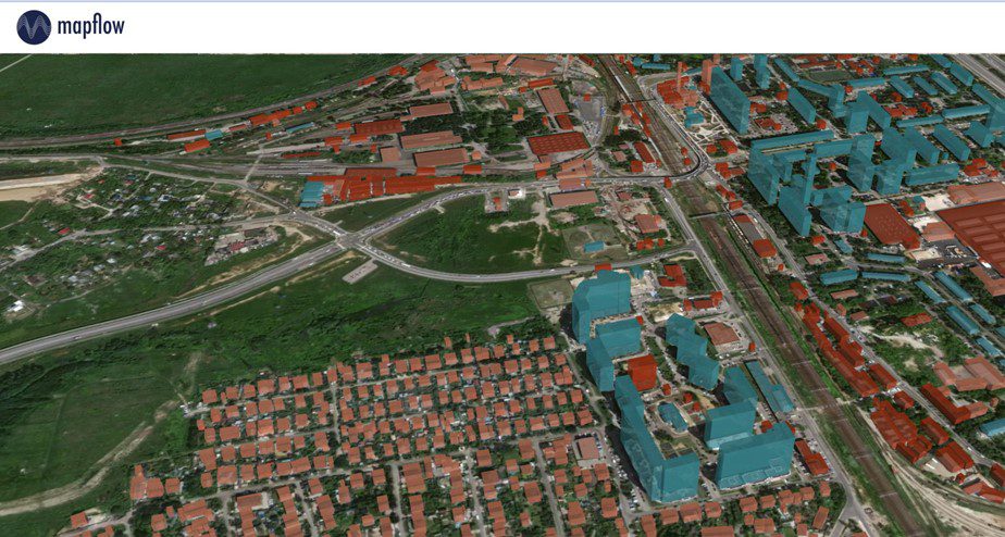
Visualized output results


https://mapflow.ai/