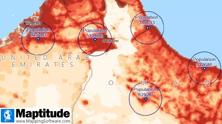
NEWTON, MA (USA) – A free world population point layer with 2020 population counts at 1km intervals is now available for download, providing the ability to analyze population anywhere on earth. The point locations can be explored with the tools and data already included with Maptitude mapping software, such as drive-time rings and market area reports. The provision of a seamless global person count supports a wide array of analytics ranging from environmental and emergency management to governmental and commercial.
The data is available to users of the latest version of Maptitude. The number of people per pixel were aggregated from a 100m resolution, with country totals adjusted to match the official UN population estimates. The map layer is perfect for analyzing population counts anywhere on earth, whether for sales/marketing territories or for radius and drive-distance calculations. The data are also available as shapefile, KML, KMZ, or GeoJSON for a fee.
Caliper is excited to be able to bring the power and flexibility of our Maptitude product suite to a global audience and to enable our customers to make geolocation-based decisions internationally. Maptitude ships with one country of your choice (see complete list), and additional Packages can be purchased separately. You can seamlessly switch between countries, which refreshes the Maptitude interface with localized tools for creating maps, finding locations, pin mapping (geocoding), and routing. There are now 33 Country Packages available for Maptitude 2021, covering North America, South America, Europe, South Africa, UAE, India, Australia, and New Zealand. If you have any questions about Maptitude or data availability contact Caliper.
Caliper Corporation develops state-of-the-art Geographic Information Systems (GIS) software. With a focus on usability, Maptitude is designed to be a cost-effective, professional global mapping software product. Maptitude enables organizations to leverage their location-based data to improve decision making and planning, while minimizing expenditure through competitively priced solutions.
Caliper is a privately held corporation and is a leading developer of mapping, redistricting, transportation, and GIS software.
