The CZMIL SuperNova combines the deep bathymetric lidar experience of Teledyne Optech with comprehensive processing software from Teledyne CARIS to provide the best geospatial solution
Vaughan, CANADA, June 22, 2021 ─ Teledyne Optech, a Teledyne Technologies [NYSE:TDY] company and global leader in advanced lidar sensors has delivered its next generation bathymetric lidar CZMIL SuperNova to leading Norwegian mapping firm Terratec AS. Terratec is the first private company to acquire the CZMIL SuperNova and the only company in the EU to engage in work around environmental change and coastal zone mapping using the CZMIL SuperNova’s powerful depth penetration and advanced capabilities.
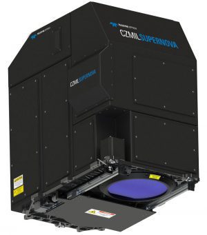
Teledyne Optech’s new CZMIL SuperNova has the best bathymetric depth performance, the highest green laser point density in its class and greatly improved range precision. CZMIL SuperNova also introduces SmartSpacing technology for even and efficient point spacing across the swath, onboard processing capability for reduced post-processing and three configurable modes for maximizing performance in different marine environments.
As a complete geospatial solution, CZMIL SuperNova has integrated industry-leading software from Teledyne CARIS, to provide seamless integration for processing and deliverables. The complete CARIS Ping-to-ChartTM workflow allows for a myriad of deliverables that go far beyond the mere point cloud. Moreover, leveraging advanced AI techniques for automated land/water discrimination and noise classification, the CZMIL SuperNova bathymetric solution effectively sets a new standard in processing workflow efficiency through automation without compromising quality.
CEO of Terratec, Oivind O. Aase stated: “Terratec is excited to be the first customer worldwide to take advantage of the new CZMIL SuperNova sensor. We have been following the development in airborne bathymetry for a long time and for us this has been a maturation process. The combination of the SuperNova hardware and CARIS processing solution represents a great step forward for airborne bathymetry. Our pilot clients are very satisfied with the results we have presented thus far. We look forward to continued collaboration with Teledyne Optech in further development of the AI algorithms to release the great potential we see in this software solution.”
Michel Stanier, Executive Vice-President and General Manager of Teledyne Optech and Teledyne CARIS commented: “We are thrilled to deliver the first privately-owned CZMIL SuperNova to Terratec. They are innovators and the leader for airborne survey in Scandinavia, and we have worked very closely with them during the development and testing of the Supernova system – sensor, software and workflow – to ensure that it is not only the highest-performing lidar bathymetry system in the world, but also that it meets the demanding processing and production requirements in the most efficient, automated manner possible. As a result, Terratec is achieving superior results in collecting and processing marine coastal zone base maps and in mapping arctic lakes in ways that could not be achieved until now. This effectively puts Terratec in a class of their own with unique bathymetry sensor, processing and production capabilities and we are proud of the outcome of this close collaboration.”
About Teledyne Optech
Teledyne Optech is a part of the Teledyne Imaging Group and a world leader in high-accuracy lidar 3D survey systems, integrated cameras, and productivity-enhancing workflows. With operations and staff worldwide, Teledyne Optech offers both standalone and fully integrated lidar and camera solutions for airborne mapping, airborne lidar bathymetry, mobile mapping, terrestrial laser scanning, and mine cavity monitoring, as well as space-proven sensors. Teledyne Optech supports its clients with an around-the-clock team, on-site service, and regular efficiency enhancements to the workflow of its integrated systems.
Teledyne Imaging is a group of leading-edge companies aligned under the Teledyne umbrella. Teledyne Imaging forms an unrivalled collective of expertise across the spectrum with decades of experience. Individually, each company offers best-in-class solutions. Together, they combine and leverage each other’s strengths to provide the deepest, widest imaging and related technology portfolio in the world. From aerospace through industrial inspection, scientific research, spectroscopy, radiography and radiotherapy, geospatial surveying, and advanced MEMS and semiconductor solutions, Teledyne Imaging offers world-wide customer support and the technical expertise to handle the toughest tasks. Their tools, technologies, and vision solutions are built to deliver to their customers a unique and competitive advantage.
For more information, visit www.teledyneimaging.com
