New Products Enable Trimble’s Global Distribution Channel to Provide a Complete,Turn-Key Automated Monitoring System for Infrastructure and Construction Projects
SUNNYVALE, Calif. — Trimble (NASDAQ: TRMB) announced today the addition of a geotechnical portfolio to its geospatial automated monitoring portfolio through a collaboration with Worldsensing, a wireless connectivity technology provider and an industry-leading manufacturer of geotechnical IoT monitoring systems. The collaboration enables survey, geotechnical and structural engineers to seamlessly expand their monitoring business opportunities with a comprehensive solution that incorporates geotechnical and geospatial data.
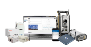
Data from a variety of geotechnical and geospatial sensors—from tiltmeters, piezometers and crack gauges to GNSS receivers and total stations—combined with wireless communication and robust software create powerful monitoring solutions. This provides unparalleled movement analysis to monitor transportation infrastructure, buildings, structures, dams, mines as well as landslides and natural hazards.
The Trimble-branded geotechnical product line, powered by Worldsensing, provides a fully automated wireless monitoring solution that helps minimize field visits and increases safety by reducing the need to obtain manual readouts. The automated measurements generate real-time notifications and reporting through the new Trimble® 4D Control™ software (T4D) Geotechnical Edition software, which enables users to streamline monitoring system deployment as well as simplify the connection to geotechnical sensors.
The Trimble geotechnical portfolio includes:
By expanding Trimble’s geospatial portfolio to include geotechnical IoT solutions, monitoring professionals can have access to both product lines from a single provider. This provides the flexibility to choose the optimal system to comprehensively monitor construction projects, mine, dam sites and other critical assets with the T4D software.
“Our monitoring customers work with geotechnical sensors to automate movement detection for critical infrastructure and mining projects on a daily basis,” said Boris Skopljak, marketing director of Monitoring and Tunneling for Trimble Geospatial. “Through our collaboration with Worldsensing, we are making it easier for them to access the full range of geospatial and geotechnical solutions from a single source, resulting in faster and easier deployment and the opportunity to address a wider range of projects.”
“Thanks to this collaboration, service providers can work with a powerful combination of geospatial and geotechnical IoT-based monitoring technologies,” said Matthieu Laville, director of Sales at Worldsensing. “They can now merge geospatial and geotechnical tools to easily collect and access sensitive and reliable data to automate their operational tasks, reduce technical complexity and diminish risks across mining, construction and rail projects.”
Availability
The solution is expected to be available through Trimble’s global Geospatial distribution channel in July 2021 via dedicated monitoring professionals, providing local sales, installation, training and technical support. For more information, visit: trimble.com/geotech.
About Worldsensing
Worldsensing is a global IoT pioneer. Founded in 2008, the industrial monitoring expert works with over 270 engineering partners in more than 60 countries to provide safety through critical infrastructure monitoring in mining, construction, rail and structural health. Loadsensing by Worldsensing enables near real-time data acquisition of geotechnical, geospatial and structural sensors as well as remote device, data and network performance tracking. Engineers and experts tasked with monitoring can simplify their project management, save time and accelerate ROI through remote connectivity management. Worldsensing has offices in Barcelona, London, Los Angeles and Singapore and investors include Cisco Systems, Mitsui & Co, McRock Capital and ETF Partners, among others. For more information about Worldsensing, visit: www.worldsensing.com.
About Trimble Geospatial
Trimble Geospatial provides solutions that facilitate high-quality, productive workflows and information exchange, driving value for a global and diverse customer base of surveyors, engineering and GIS service companies, governments, utilities and transportation authorities. Trimble’s innovative technologies include integrated sensors, field applications, real-time communications and office software for processing, modeling and data analytics. Using Trimble solutions, organizations can capture the most accurate spatial data and transform it into intelligence to deliver increased productivity and improved decision-making. Whether enabling more efficient use of natural resources or enhancing the performance and lifecycle of civil infrastructure, timely and reliable geospatial information is at the core of Trimble’s solutions to transform the way work is done. For more information, visit: https://geospatial.trimble.com.
About Trimble
Trimble is transforming the way the world works by delivering products and services that connect the physical and digital worlds. Core technologies in positioning, modeling, connectivity and data analytics enable customers to improve productivity, quality, safety and sustainability. From purpose built products to enterprise lifecycle solutions, Trimble software, hardware and services are transforming industries such as agriculture, construction, geospatial and transportation. For more information about Trimble (NASDAQ:TRMB), visit: www.trimble.com
