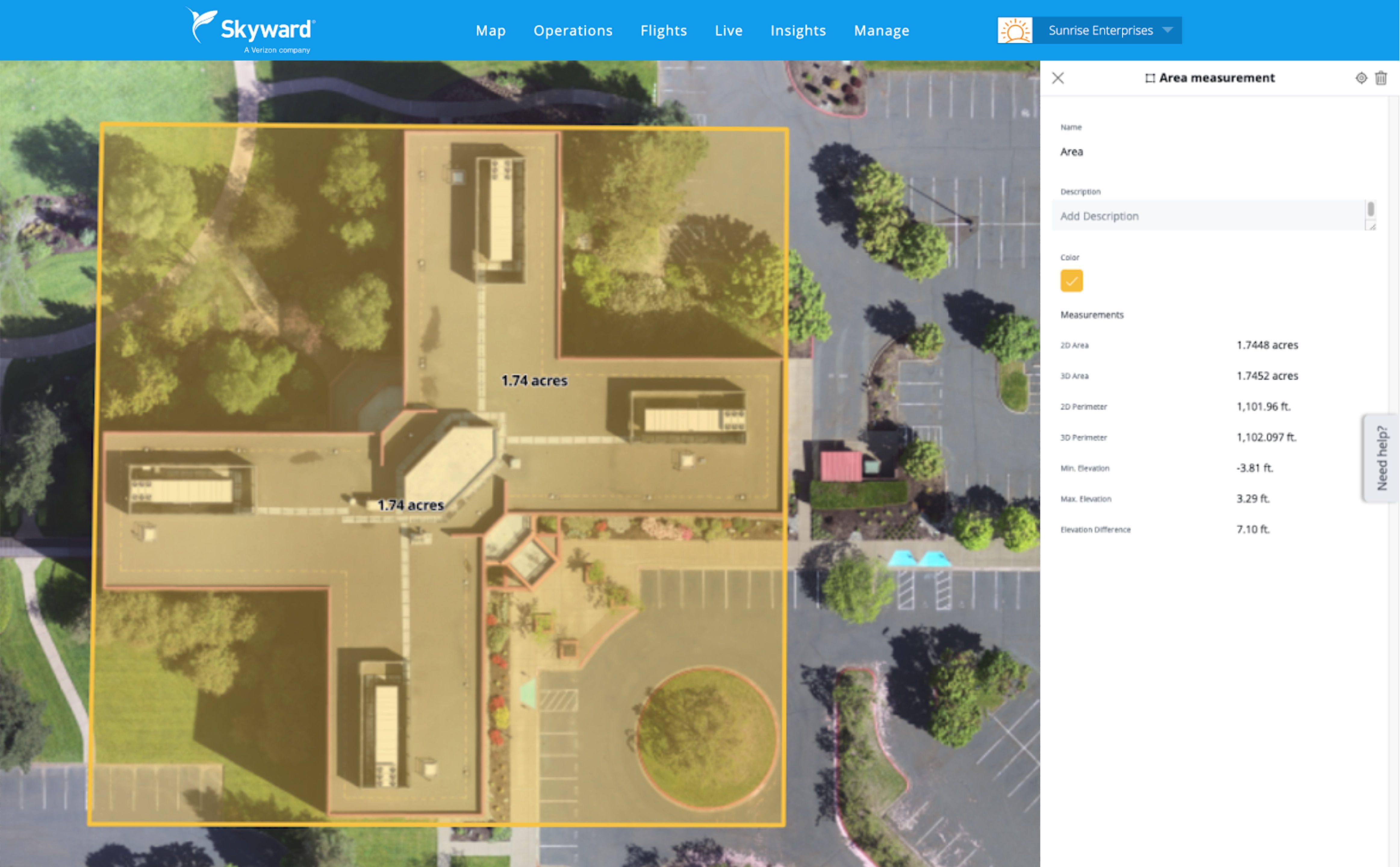
Skyward Mapping & Modeling, powered by Pix4D, enables customers to create, view, measure, and export 2D orthomosaic maps and 3D photogrammetric models right from Skyward’s web app
PORTLAND, Ore. – Today, Skyward, A Verizon company, announced its integration with Pix4D, giving customers the ability to turn drone data into 2D maps and 3D models. Enterprises and drone pilots can now plan flights, receive approval to fly in controlled airspace with LAANC, fly with Skyward’s InFlight ground control station, and process data using Pix4D — all from within the Skyward platform.
“Skyward has been bringing our customers tools to access airspace, plan, and fly — now they can produce business-ready data deliverables without leaving Skyward,” said Mariah Scott, Skyward President. “Enterprises in construction, energy and utilities, and the public sector can get even more ROI out of their drone programs when combining Skyward’s drone management platform with Pix4D’s market-leading photogrammetry tools.”
Transform drone data into business-ready deliverables
Skyward Mapping & Modeling, powered by Pix4D, enables customers to create, view, measure, and export 2D orthomosaic maps and 3D photogrammetric models right from Skyward’s web app. With the processing power of Pix4D, the market leader in photogrammetry software technology, Skyward customers can get business-ready data sets through a seamless plan, fly, process workflow.
“Enterprises are seeking to scale their drone operations and transform their businesses with better data and faster time-to-insight. Skyward’s platform, along with the power of Pix4D, delivers a powerful, comprehensive solution,” said Christopher Cressy, Pix4D Managing Director for North America.
To learn more about Skyward’s mapping and modeling features, join our webinar on June 8 at 2 p.m. ET. Enterprises and commercial operators can try Skyward Mapping & Modeling powered by Pix4D free for 30 days.
Verizon Communications Inc. (NYSE, Nasdaq: VZ) was formed on June 30, 2000 and is one of the world’s leading providers of technology, communications, information and entertainment products and services. Headquartered in New York City and with a presence around the world, Verizon generated revenues of $128.3 billion in 2020. The company offers data, video and voice services and solutions on its award-winning networks and platforms, delivering on customers’ demand for mobility, reliable network connectivity, security and control.
