BRISBANE, Australia – Global technology company Emesent today announced the release of the Colourisation functionality for its Hovermap LiDAR scanner.
The 3D point clouds from Hovermap can now be augmented with true colour, providing additional context for visualisation and analysis.
“We’re excited to announce this significant new feature for Emesent,” said Emesent’s CEO and Co-Founder Stefan Hrabar. “Colourisation provides greater insights for our customers across many industries. This builds on the incredible 3D data that Hovermap produces to create rich, accurate digital twins and surveys”
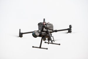
The new colourisation feature for Hovermap utilises the latest rugged action camera – the GoPro Hero8. This modular approach extends the versatility and flexibility of Hovermap, allowing customers to attach the camera when colourised scans are needed.
As before, Hovermap can be used on a drone, as a hand-held or backpack mounted scanner with the supplied handle or a range of other accessories. When the camera is attached Hovermap is just as versatile but with the added benefit of providing colourised scans.
Scanning and data processing remain as easy as always. Hovermap and the camera are started with the push of a button, and after capture the LiDAR and video data are processed via a simple Drag- and-Drop workflow. For advanced users, a vast range of parameters are also made available to further adjust processing and output options.
“Combining camera and LiDAR data from a moving scanner is actually a very challenging task which requires precise calibration and synchronisation between the two sensors.” explains Dr Farid Kendoul, CTO and Co-Founder of Emesent. “We’ve developed advanced algorithms to handle this complexity, keeping it simple and easy for our customers to use. The results are really amazing to see.”
In addition to producing a colourised point cloud, the process also outputs a set of images and image pose data (position and orientation relative to the point cloud). This allows the LiDAR data and images to be imported into a variety of third-party tools to be shown side-by-side.
The new colourisation feature has already been tested by a number of users at various sites, producing impressive results.
“We found the Hovermap colourisation option very easy to use and it has generated great results,” said Alex Paulusson CEO of Swedish Geodata and Remote sensing specialists AMKVO. “Having the ability to simply attach the camera as needed is a great feature too. This will add a new and valuable dimension to our clients’ Hovermap scans.”
About Emesent
Emesent is a world-leader in drone autonomy, LiDAR mapping, and data analytics. Since its inception in 2018, Emesent has built a reputation for delivering advanced autonomy and high-quality data capture in the mining, infrastructure, and forestry industries. Their flagship product, Hovermap, is a smart mobile scanning unit with a simultaneous localisation and SLAM-based mapping system. Hovermap can be handheld or mounted to a drone or vehicle to provide autonomous mapping in challenging, inaccessible areas. With an extensive list of global distributors, Emesent’s solution includes hardware, software, and services.
