Haverhill, MA – Satellite and airborne hyperspectral imaging is a technology used in a wide range of remote sensing and geological applications. Ground truthing provides the ability to calibrate hyperspectral images for atmospheric correction and sensor calibration. SPECTRAL EVOLUTION designs and manufactures field portable spectroradiometers, spectrometers and accessories to make calibration of reflectance for an image easier, more reliable, and more accurate.
Hyperspectral imaging allows researchers to detect patterns and identify surface materials from a distance. Hyperspectral image data can be collected from satellites, airplanes, or UAVs. Hyperspectral imaging systems acquire images in over one hundred contiguous spectral bands. Hyperspectral imaging collects data to generate a data cube that can reveal objects and information. Each scanned area leaves a unique spectral signature, also called a spectral reflectance curve, in various bands of the spectrum, based on its spectral reflectance. Hyperspectral imaging can provide important information on vegetation health whether measuring crops, fields, or forest canopies and can identify minerals in surface features including outcrops, pits and benches.
Applications of hyperspectral imaging in remote sensing and geological remote sensing include:
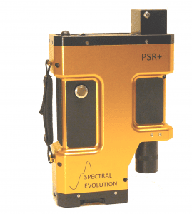
SPECTRAL EVOLUTION’S spectrometers and spectroradiometers are single point systems that cover the full VNIR and SWIR spectral range from 350-2500nm. Remote sensing models include the SR-6500, RS-8800, RS-5400, PSR+, and RS-3500. These instruments are designed for field use – rugged design and construction, no moving parts, lightweight and powered by lithium-ion batteries. Our instruments deliver better spectral resolution, signal to noise and spatial resolution capabilities than hyperspectral imaging cameras.
In the field they are used to calibrate hyperspectral images for reflectance and radiance. Reflectance calibration uses measurements of ground reflectance of a target – either a calibrated target or just a uniform surface like a desert or a parking lot. This measurement calibrates the whole image for reflectance.
Radiance is measured at ground reflectance points that match to satellite images. These measurements capture the “true” radiance at the ground that corresponds to a pixel in the image captured by the hyperspectral sensor. Radiance is the intensity of light energy from the sun reflecting off the earth and traveling through the atmosphere to the sensors in the satellite. Radiance measurements can be used to model the atmosphere. The difference between the ground radiance and the radiance acquired from the satellite image indicates what is being absorbed by the atmosphere. Radiometric calibration ensures radiance and its intensity are correct in the satellite image.
Our field portable spectrometers and spectroradiometers deliver measurements that can be used as ground truthing datasets to validate the data produced by hyperspectral imaging systems. Areas in satellite images of low spatial or spectral resolution can be more closely inspected in greater detail using field data from a field portable spectroradiometer. Ground truthing is a necessary step in improving the accuracy and analysis of data collected via hyperspectral imaging and corroborates or contrasts with hyperspectral images from satellites and UAVs that can be affected by environmental conditions, ground cover and other field variabilities.
In situ measurements can also compensate for sun angle effects and specular reflectance variances in airborne measurements. Ground truthing can provide a true measurement of a research area.
For more information, visit: www.spectralevolution.com
About SPECTRAL EVOLUTION
Established in 2004, SPECTRAL EVOLUTION is a leading manufacturer of laboratory and handheld portable spectrometers, spectroradiometers and spectrophotometers. SPECTRAL EVOLUTION spectrometers are used worldwide for many mission-critical lab and field applications in mining, remote sensing, vegetative studies, ground truthing, environmental and climate studies, developing satellite calibrations, and more, due to their reliable, robust, rugged design and user-friendly one-touch features.
