Over the last few months, Skyward has been hard at work on the latest developments in our Aviation Management Platform. Today, I’m excited to announce a brand new feature to support program oversight and risk mitigation: Live Flights. With today’s release, you can monitor your drone flights anywhere you have connectivity: from the office, the field, or even at home. Live Flights also serves as a foundation for Skyward’s implementation of Remote ID.
You can learn more about Live Flights and other new features in Skyward’s upcoming webinar: Drone Program Management – Inside the Skyward Platform.
No matter where you’re running your drone operations from, Skyward now offers the capability to see all your organization’s active drone flights in essentially real time. For managers in the office, this empowers greater oversight and transparency across the organization. For pilots in the field, it increases situational awareness and supports coordination during complex aviation operations.
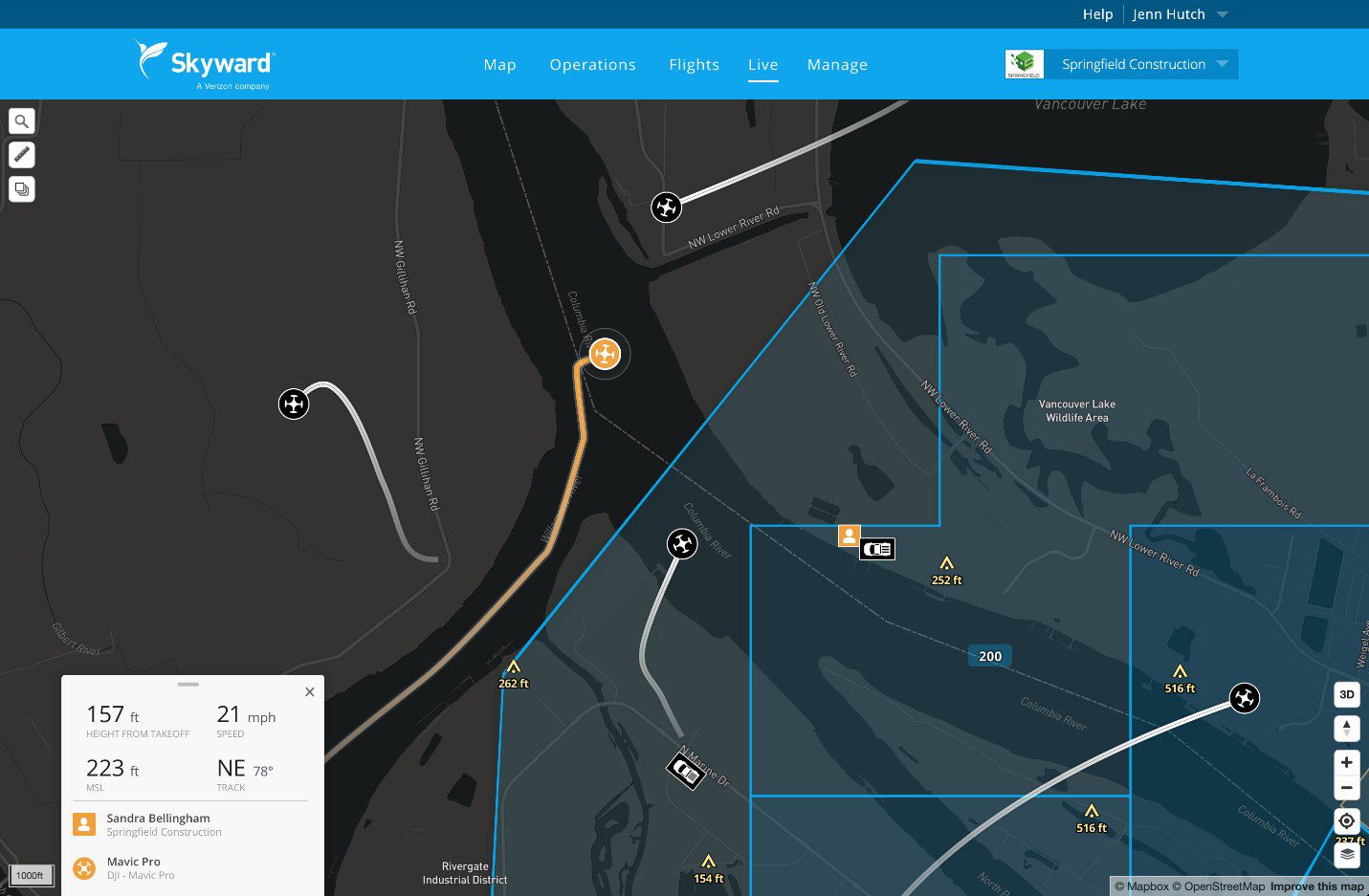
When subscribers fly with Skyward’s InFlight mobile GCS, aircraft information is sent into Skyward’s new Live Flights map. The map offers at-a-glance information including the drone’s location and flight path over the last 60 seconds. When you click on a drone, the map displays detailed information about the flight including aircraft ID, location, altitude, and velocity, as well as the location of the GCS and key pilot information. This information is visible on Skyward’s web and mobile apps to everyone within the organization.
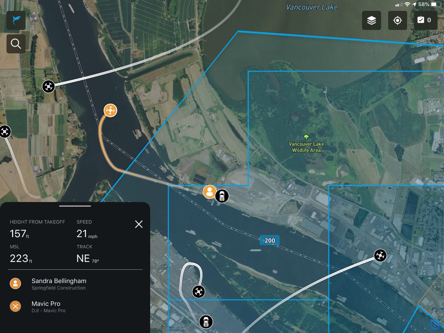
Customers with an Enterprise Skyward subscription can also use InFlight to self-report their location, flagging the position of items such as vehicles, observers, drones not compatible with InFlight, or landmarks. And administrators of enterprise accounts can see live flight information for all the organizations they manage.
A basis for Remote ID
Live Flights serves as a foundation for Skyward’s implementation of Remote ID. With the ability to transmit live position and identification data, Skyward aims to become a Remote ID UAS Service Supplier (USS). Today, Skyward lets program managers know who’s flying and where, improving visibility and compliance for enterprise drone programs. Tomorrow, we look toward a system of Universal Traffic Management in the National Airspace System.
For detailed information on how to use Live Flights, visit the Skyward User Guide Page. Please note that InFlight currently supports only DJI aircraft, with additional aircraft planned for the future.
Live Flights puts even more airspace intelligence and management tools at your disposal to help you oversee your drone program as safely and efficiently as possible. To get started, visit the web app or log into InFlight. If you aren’t a Skyward subscriber, see how Skyward’s Aviation Management Platform can help your drone program improve airspace intelligence, safety, and efficiency.
By Sam Ewen
Product Manager
Skyward, A Verizon company
