One-Inch GNSS Accuracy in Under a Minute, Delivering Seamless High-Precision Performance Across the U.S. and Southern Canada
SUNNYVALE, Calif. —Trimble (NASDAQ: TRMB) announced today the completion of the breakthrough expansion of its CenterPoint® RTX Fast correction service, with coverage now spanning the contiguous U.S. and southern Canada. This expansion is central to Trimble’s vision to transform how and where users can leverage precision and accuracy. Ideal for autonomous applications in both on-road and off-road markets, the coverage and performance of the service enables industry professionals to re-think what is possible when using augmented positioning for improving safety, performance, productivity and operational efficiency.
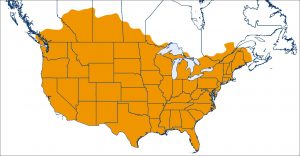
Trimble’s CenterPoint RTX U.S. and Canada coverage map
The CenterPoint RTX Fast subscription service delivers horizontal positioning accuracy of one inch (two centimeters) or less in under a minute, with the versatility of satellite or cellular delivery. This expanded coverage makes it the largest, high-performance GNSS correction network in the world. No other GNSS correction service provides this combined level of accuracy, convergence speed, flexible delivery and geographic coverage. For a full coverage map, visit: http://positioningservices.trimble.com/resources/coverage-maps.
Now, with over 5 million square miles of CenterPoint RTX Fast network coverage worldwide, users across North America and Europe, including farmers, land surveyors and GIS professionals can untether from the cost and complexities of GNSS base stations. In addition, Trimble RTX Fast offers a single, continuous correction technology platform ideal for enabling a broad range of safety-critical autonomous applications in markets such as automotive, agriculture and construction.
“This achievement is a major milestone in the continuous evolution of our correction service and autonomy strategy. We are delivering unmatched access to fast, reliable, highly accurate positioning in more areas than ever before,” said Patricia Boothe, senior vice president of Trimble’s Autonomy Sector. “Whether enhancing performance in the autonomy ecosystem or simplifying traditional mapping and surveying workflows, RTX Fast users can gain greater accuracy to improve productivity and operate safely—ultimately transforming the way they work and drive.”
Availability
CenterPoint RTX Fast subscriptions for Trimble RTX-compatible GNSS receivers are available through Trimble’s Authorized Business Partners or Trimble’s online store at: tpsstore.trimble.com.
About Trimble RTX
Trimble RTX technology utilizes data from a global reference station network to compute high-accuracy positions based on satellite orbit and clock information. Trimble RTX supports a suite of real-time correction services delivering a range of accuracies from better than two centimeter to sub-meter performance in as fast as one minute. Trimble RTX-based positioning services are available via convenient, easy to access satellite delivery or via IP/cellular communication, providing users with flexible options to obtain high-accuracy positions in nearly any work environment. Trimble RTX correction services are available throughout most of the world. For more information, visit: https://positioningservices.trimble.com.
About Trimble
Trimble is transforming the way the world works by delivering products and services that connect the physical and digital worlds. Core technologies in positioning, modeling, connectivity and data analytics enable customers to improve productivity, quality, safety and sustainability. From purpose built products to enterprise lifecycle solutions, Trimble software, hardware and services are transforming industries such as agriculture, construction, geospatial and transportation. For more information about Trimble (NASDAQ:TRMB), visit: www.trimble.com
