
Rome, NY – Rome, NY – Microdrones is releasing three new Integrated UAV Systems based on the heavy lifting power, resilience and efficiency of the Microdrones md4-3000 aircraft: the mdMapper3000DuoG VHR, the mdMapper3000DuoG, and the mdMapper3000 PPK.
The company has also updated the mdTector1000CH4 LR with a Pergam Laser Methane Falcon sensor for detecting Methane (CH4) and methane-containing gases.
Additionally, Microdrones is preparing to release mdInfinity, a new software package that will enable users to quickly and efficiently process geospatial data.
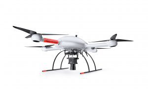
The mdMapper3000DuoG VHR combines the Microdrones md4-3000 aircraft platform, with a perfectly integrated Phase One camera and the power of direct georeferencing. This results in an unparalleled one-pixel mapping accuracy from a 1000 ft. drone flight height.
Vivien Heriard-Dubreuil, President of Microdrones, anticipates the system will break ground in new markets for the company. “We’re packaging manned aircraft aviation quality technology into a UAV system so that Microdrones can serve customers who have a need for wide-area mapping with unparalleled accuracy and deliverables,” he explains. “Our mdMapper3000DuoG VHR can fly higher altitudes and provide ultra-high-resolution for the most accurate and dense data for mapping service providers.”
The ultra-high-resolution stems from the 100-megapixel Phase One iXM-100 camera that is paired with a custom, lightweight, vibration-free, quick connect mount. Dr. Mohamed Mostafa, Director of mdSolutions at Microdrones says, “This system is a game-changer for Microdrones as now we can compete in some of the same arenas that photogrammetry professionals relied on manned aircraft for. You can fly the mdMapper3000DuoG VHR at a height of 1,000 feet and achieve triple the image quality and double the Direct Georeferencing in just half the time without all of the traditional manned aircraft expenses.”
Also being released is the new mdMapper3000DuoG, equipped with direct georeferencing and a 42.4-megapixel Sony RX1R II camera paired with a custom, lightweight, vibration-free, nadir mount. This professional mapping integrated system will quickly acquire highly dense and accurate data, in half the time of PPK based systems and can easily be upgraded to VHR or LiDAR by purchasing the payload(s) and related firmware and software subscriptions.
Rounding out the new product releases is the mdMapper3000 PPK, a powerful, highly expandable system that can acquire dense and accurate data with just 1-3 ground control points. Also featuring a 42.4-megapixel Sony RX1R II camera and nadir mount, this system is DuoG ready and is easily upgradeable via firmware to direct georeferencing.
“All of these new systems are designed, engineered and built for professional mappers to build professional-grade mapping products,” says Vincent LeGrande, Microdrones Vice President of Global Sales. “Furthermore, these systems can grow with you. So, if you start with the PPK, it’s upgradeable to add Direct Georeferencing or expand further to incorporate VHR or LiDAR. These packages are all about resilience, convenience, and geomatics performance.”
Microdrones also announces the updated mdTector1000CH4 LR, which is integrated with a Pergam Laser Methane Falcon sensor for detecting Methane (CH4) and methane-containing gases from the sky. The upgraded sensor offers a significant weight reduction by drawing on the drone power source and removing the display on previous generation detectors. Information is displayed via the mdCockpit tablet software during flight, and via area concern maps post-flight.
The new Microdrones mdInfinity software package is coming soon in 2020 and will become the backbone of the Microdrones product ecosystem. The first module to be introduced will be trajectory processing, followed by Pointcloud Georeferencing, Boresight Calibration, and Pointcloud Colorization.
For specs, product performance and other details CLICK HERE to download a copy of the new Microdrones Product Catalog.
About Microdrones
Founded in Germany in 2005, Microdrones developed the world’s first commercial quadcopter and the company continues to lead the industry with their professional UAV solutions.
By pairing robust drones with cutting-edge sensors, Microdrones offers advanced turn-key solutions that make it easy for businesses to start using UAVs for surveying, mapping, construction, inspection, precision agriculture, mining, and other commercial applications. A heritage of quality German engineering, extra-long flight times, resistance to environmental challenges, and technology like direct georeferencing make Microdrones solutions exceptionally safe, efficient, and cost-effective choices for commercial users.
Microdrones serves markets around the globe. To learn more about Microdrones, visit www.microdrones.com.
