
UK water initiative gains recognition for open data sharing portal
Stream, a UK water open data initiative, has won an Esri ‘Special Achievement in GIS Award’ for its pioneering work in helping water companies to share their data with each other and various stakeholders, including innovators, citizens, regulators and interest groups. Designed to foster collaboration, innovation and trust, Stream’s mission is to unlock the potential of water data to benefit customers, society and the environment.
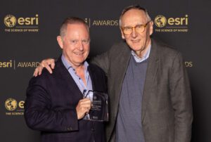
The award was presented at the Esri annual User Conference in California, one of the world’s largest geospatial industry events with around 40,000 physical and virtual attendees. Stream was recognised for its geospatial leadership and setting new standards for the global GIS (Geographic Information System) community. Selected from hundreds of thousands of candidates, the winners were chosen by Esri’s President Jack Dangermond.
Esri technology has been used to create Stream’s open data sharing portal – a central hub containing and connecting to a wide range of data from UK water companies, including natural environment and water consumption information.
“Stream is delighted to receive this award and be recognised for its landmark innovation,” said Nigel Watson, Group CIO for Northumbrian Water Group and executive sponsor for Stream. “Driving improved transparency, collaboration and smarter decisions, the open data platform is the foundation of a new era for the UK water sector. Stream is quickly becoming a core piece of UK national data infrastructure thanks to the unprecedented level of collaboration.”
One of Stream’s early successes was the delivery of the National Storm Overflow Hub. Delivered in partnership with Water UK, the hub presents the world’s first interactive storm overflows map and associated APIs, showing the location and live operation of every single storm overflow in England in near-real time.
Providing one source of standardised overflow data, from all water companies for the first time, has enabled broad use of the data by third parties. Examples range from notification apps for recreational water users, modellers developing new ways of predicting and improving river health and regulators monitoring water company performance. The event feed is available on open licence allowing anyone to consume the data, marking a key milestone in driving transparency and innovation in the sector.
“Users around the world are demonstrating that geospatial technology enables us to see complex problems better to understand them, re-imagine them and reveal solutions,” said Esri President Jack Dangermond. “It is my honour to recognise these organisations for all the unique ways they are using GIS to innovate across industries and improve decision-making.”
Since the Stream platform went live in April 2024:
Stream selected Esri for the initiative following an open tender, due to its ability to deliver a cost-effective system, which needed no additional customisation. Esri technology provides the open data sharing portal but also allows users to investigate and understand the data using interactive maps and other geospatial tools.
About Stream
Stream is a collaboration between UK water companies, supported by industry and civil society partners with a vision to unlock the potential of water data to benefit customers, society, and the environment. The Stream open data platform enables users to find, understand and access the data they need to develop insights, and the data sharing infrastructure created provides the community, processes and technology needed to create value from this data. Stream is an agile, evolving institution that advances environmental stewardship, drives efficiencies and fosters innovation and transparency; working with others to protect and improve our water and waste water systems for generations to come.
Website: www.streamwaterdata.co.uk
About Esri and the SAG Awards
Founded in 1969, Esri is the global market leader in Geographic Information System (GIS) software, location intelligence and mapping.
UK customers include Anglian Water, Northumbrian Water, Severn Trent Water, the Environment Agency and Ordnance Survey.
Since it was established in 1998, the SAG Awards have demonstrated an appreciation for organisations that are using GIS to reveal patterns and trends from data to address some of the world’s most pressing challenges.
Website: www.esriuk.com/en-gb/industries/water/overview
