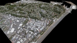
BRISBANE, Australia — Woolpert and iXblue Sea Operations division, part of the French-based iXblue Group, have been awarded two significant airborne lidar mapping projects in New Zealand, covering over 38,500 square kilometres for the Hawke’s Bay and Waikato regional and local councils.

These projects are part of the New Zealand government’s Provincial Growth Fund Lidar program in which the Ministry of Business, Innovation and Employment, Land Information New Zealand and councils are working together to develop 3D models of landscapes that contribute to the economic development of regional New Zealand.
The lidar information has intended use with land management decisions, road design, precise understanding of sea-level rise impacts, stormwater design, and geohazard mapping including surface change, faults, liquefaction and slips.
iXblue and Woolpert formed their strategic partnership in 2019 and have steadily built its regional capability. Their key focus is the collection, processing and delivery of airborne digital imagery, topographic lidar and bathymetric lidar operations from helicopter and fixed-wing platforms providing custom solutions to commercial and government clients across Australia and New Zealand.
iXblue’s General Manager Airborne, Matthew James, said: “We are privileged to have been awarded these major projects in New Zealand. The team has built a strong technical offering that aims at using the latest sensors and processing techniques available, with a strong customer relationship focus to deliver world class products.”
“Woolpert is excited to work with our partners at iXblue and participate in the New Zealand projects,” said Joseph Seppi, Woolpert’s Geospatial Sector Leader. “By playing to our firms’ combined strengths, we will deliver highly accurate mapping data with the professional competency and experience that we are known for.”
Media contact: [email protected]
About Woolpert
Woolpert is committed to a vision to become the premier architecture, engineering and geospatial (AEG) firm, and one of the best companies in the world. It is a vision we’ve been fine-tuning for decades. It guides our decisions and investments, provides our clients with optimal solutions, and offers our employees unrivalled opportunities. Woolpert is recognized as a Great Place to Work by its employees and is America’s fastest growing AEG firm. With more than a century of experience, close to 1,000 employees and 30 offices, Woolpert supports public, private, federal, and military clients nationally and around the globe. For more information, visit woolpert.com and connect with us on LinkedIn, Twitter and Facebook.
About iXblue
iXblue is a global high-technology company specializing in the design and manufacturing of advanced marine, photonics and autonomous technologies. The group in-house expertise includes innovative systems and solutions devoted to inertial navigation, subsea positioning, underwater imaging, hydrographic and geophysical surveying, as well as shipbuilding, test & simulation. iXblue technologies support Civil and Defence customers in carrying out their sea, land and space operations with maximum safety, efficiency and reliability. Employing a workforce of 650 people worldwide, iXblue conducts its business in over 60 countries. www.ixblue.com