
KazUAV is leveraging 3D mapping drones to help the World Bank create a highly-detailed database of educational infrastructure facilities in Kyrgyzstan
Nur-Sultan, Kazakhstan – January 17, 2020 – KazUAV, a group company of Japan-based Terra Drone Corporation, has been supporting the World Bank in its initiative to build sustainable school infrastructure in the Republic of Kyrgyzstan. As part of the General-Purpose Simulation Program (GPSS) under the Global Facility for Disaster Reduction and Recovery (GFDRR) grant-funding mechanism of the World Bank, KazUAV has surveyed and mapped Kyrgyz schools for a pilot project.
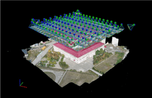
A highly-detailed database of the educational infrastructure facilities – consisting of geographic coordinates, aerial imagery, orthophotomaps, and 3D models of the school buildings – has been created by KazUAV to help the World Bank make better decisions for improving the safety and functional conditions of schools in Kyrgyzstan.
In the pilot, 12 schools in the Kyrgyz capital of Bishkek have been mapped. All the schools selected had varied architectural configurations and were located at different distances from the city center.
Using unmanned aerial vehicles (UAVs) or drones from KazUAV allowed the World Bank to get a complete picture of the current condition of the school façade, including the presence of potential loss of integrity in the wall and roof structures. By inspecting the surrounding area of the schools, KazUAV was also able to determine the ease of access for emergency transport services as well as the presence or absence of obstructions like fences and wetlands, etc.
On average, 1,200 data points were captured at each facility, allowing KazUAV to deliver accurate 3D models of the school buildings and orthophotomaps with a spatial resolution of 1-1.5 cm/pixel.
After successfully completing this first-of-its-kind initiative in Kyrgyzstan, KazUAV has been able to share its learnings and recommendations with the World Bank, enabling the agency to determine if and when such a project can be rolled out on a nationwide basis.
Dmitriy Ivanov, Director, KazUAV, says, “Collection of accurate and comparable data with drones for construction of photomaps, 3D modeling, and real-time monitoring, plays an important role in monitoring and analyzing the current state of sites and territories, as well as the operational situation in any given area. Given the multifaceted capabilities of modern UAVs, as well as the successful experience of their operations for several years by the KazUAV team in different climatic zones and under different weather conditions, I’m positive that their use can be highly-effective for the World Bank for solving a wide range of tasks.”
About KazUAV
KazUAV is widely known in the Kazakhstan drone ecosystem for having provided unmatched GIS services to several government agencies and private companies, including mapping several of the country’s airports and providing surveillance services to the Kazakhstani special forces. KazUAV specializes in providing unmanned solutions for power line inspection and vegetation management for the energy sector; onshore/offshore infrastructure inspections, tanks inspections, and nondestructive testing for the oil and gas industry; and open-pit and underground mapping services for the mining sector.
About Terra Drone Corporation
Established in 2016, Terra Drone Corporation has quickly become one of the world’s largest industrial drone solution companies employing more than 550 drone industry professionals. The company’s head office is located in Tokyo, Japan, with over 30 branches spread throughout Asia, Europe, the Americas, Africa, and Oceania. Terra Drone provides innovative enterprise drone services for oil and gas, utilities, renewables, mining, construction, and GIS sectors, among others.
Previous investments include Unifly, which specializes in unmanned traffic management (UTM); C-Astral, which develops high-endurance fixed-wing UAVs; RoNik Inspectioneering, which provides wireless inspection services for confined spaces; Ventus Geospatial, which has patented gas leak detection technology; and Inkonova, which has developed SLAM technology for underground mines. Terra Drone plans to continue investing in technology companies with cutting-edge solutions for drones.
About the World Bank
The World Bank is a vital source of financial and technical assistance to developing countries around the world. Established in 1944, the World Bank Group is headquartered in Washington, D.C., and has more than 10,000 employees in more than 120 offices worldwide.
The Global Facility for Disaster Reduction and Recovery (GFDRR), a grant-funding mechanism managed by the World Bank, is a global partnership that helps developing countries better understand and reduce their vulnerability to natural hazards and climate change.
To see this news on Terra Drone website, click here
