Asian Surveying & Mapping
Breaking News
Intermap Announces $1 Million Program in Malaysia and Business Updates
DENVER – Intermap Technologies (TSX: IMP; OTCQB: ITMSF) (“Intermap” or...
From Kuala Lumpur To Singapore: Malaysia’s High-Speed Rail Resurgence Sparks China’s Pan-Asia Vision
The Malaysian government is once again working on building...
Japan’s Synspective successfully launches fourth SAR satellite
Synspective, the Japanese provider of Satellite/Synthetic Aperture Radar (SAR)...
South Korea’s Joowon Industrial Selects Aeva 4D LiDAR for Automated Power Line Inspection Program
MOUNTAIN VIEW, Calif. & SEONGNAM CITY, South Korea- Aeva®...
Synspective’s SAR Satellite, StriX-3, Successfully Reaches Its Target Orbit and Spreads Its Wings
TOKYO, 2024, March 13 – Synspective Inc., a SAR...
Indian Prime Minister Narendra Modi Commissions Genesys Digital Twin Map Stack in His Parliamentary Constituency
Mumbai: The Prime Minister of India, Mr. Narendra Modi, recently...
Geo Connect Asia 2024 to unveil geospatial’s transformative power
Geo Connect Asia (GCA) is set to return to...
Iran launches ‘domestically developed’ imaging satellite from Russia
The launch of Pars 1 is fourth this year,...
Astranis relocating hobbled debut satellite from Alaska to Asia
TAMPA, Fla. — Astranis is moving its debut satellite...
Asia space race heats up as China, Japan and India reach for the stars
After another year of US aeronautics company SpaceX dominating...

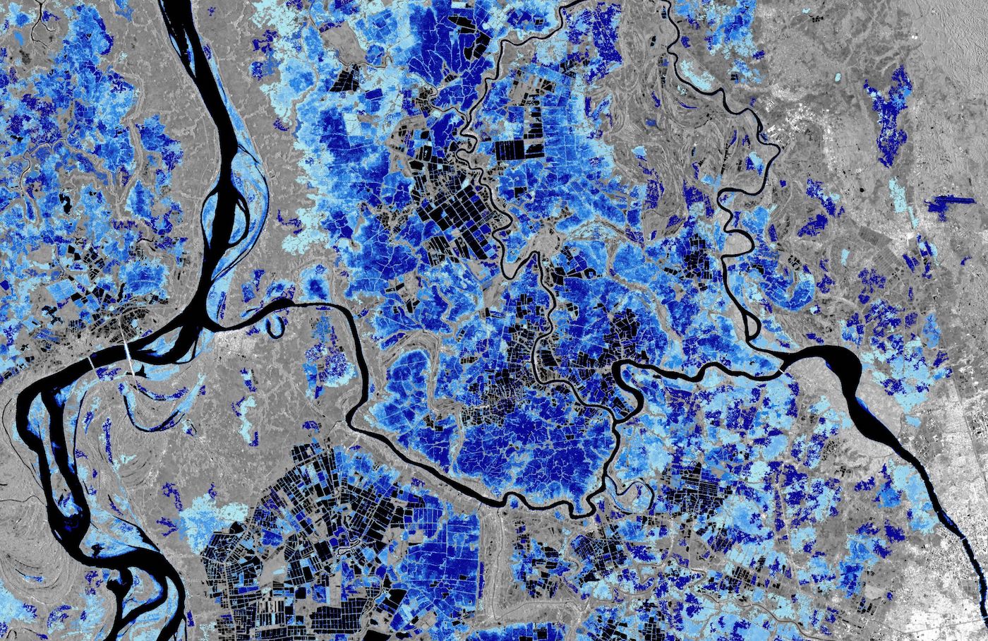
Dark areas represent permanent water bodies or fields frequently or always covered by water, for example rice fields. Different shades of blue represent the flood occurrences frequency estimated from the Copernicus Sentinel-1 data archive (light blue: less frequent; dark blue: more frequent).

Image Credit: contains modified Copernicus Sentinel data (2021), processed by LIST