Asian Surveying & Mapping
Breaking News
Launch of Australia’s 1st orbital rocket, Gilmour Space’s Eris-1, delayed again
Update for 6:15 p.m. ET on July 1: Gilmour Space...
SAASST, UAE Space Agency strengthen scientific partnership
SHARJAH- Prof. Hamid M.K. Al Naimiy, Director of the...
Shubhanshu Shukla to speak to students and ISRO scientists this Friday
Indian astronaut Shubhanshu Shukla will interact with school students...
ISRO hands over 10 advanced technologies to Indian firms in major push for space commercialisation
The Indian Space Research Organisation (ISRO) has transferred ten...
DIGIPIN Launched: India Embraces Geospatial Precision in Digital Addressing
IIT Hyderabad (IITH), in partnership with the Department of...
HAL to build, market Isro’s SSLV in landmark deal
New Delhi, Jun 20: In a historic move for...
Taiwan developing space capabilities for all-weather imaging
TAIPEI (TVBS News) — Taiwan is advancing its space...
Honda hails successful test of reusable rocket as it looks to get into the space business
Tokyo — Japan's second-biggest carmaker, Honda, has successfully tested...
China’s space program provides larger platform for broader international cooperation
BEIJING -- Experts from China's manned space program said...
India To Launch $1.5 Billion Joint Earth Mission With NASA In July
National Aeronautics and Space Administration (NASA) and the Indian...

Products

Sunday, December 18th, 2011

PortVision SmartOps Fleet Management System for Liquid Cargo Marine Transportation Companies

PortVision today announced the SmartOps Fleet Management System, which extends the benefits of the company’s AIS-based vessel-tracking system to provide an enterprise resource management system and automate a comprehensive range of unit tow business processes.

Sunday, December 18th, 2011

Onset Announces New Sensor for Wind Monitoring

Onset the world’s leading supplier of data loggers, today announced its new Wind Direction Smart Sensor, a research-grade plug-and-play sensor for measuring and logging wind direction data The easy-to-use sensor, which works with the company’s award-winning HOBO Weather Stations,...

Friday, December 16th, 2011

Gatewing Stretchout – UAV Desktop Processing Solution

With Gatewing's Stretchout desktop software, we've challenged the accepted way of traditional photogrammetry by introducing highly advanced vision technology that changes the way you process your images. Stretchout runs fully automatic at the best possible performance and...
Wednesday, December 14th, 2011

Next Generation Focus3D Laser Scanner

FARO announces new state-of-the-art 3D Documentation technology. New Multi-Sensor hardware feature includes the Compass and Height Sensor which complement the existing Dual Axis Compensator for the FARO Focus3D. The two new sensors deliver the orientation and the...

Tuesday, December 13th, 2011

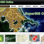
SuperGeo Announces SuperGIS Online Website

SuperGeo announces that SuperGIS Online Website is officially launched, making the GIS data and services accessible through the Internet.

Monday, December 12th, 2011

Navman Wireless Rolls Out Reporting Application

PS fleet management technology company Navman Wireless has rolled out a free over the air software update to its vehicle tracking software, OnlineAVL2. The Dynamic Dashboard platform was a reporting application that analysed vehicle trends such as idling...

Monday, December 12th, 2011

Headwall Imaging Sensor Aboard Small UAVs

Headwall Photonics has announced that its Micro-Hyperspec imaging sensor is being successfully deployed aboard very small commercial UAVs to help agriculturalists and researchers monitor vegetation over wide areas. Accurate spectral scenes of farmlands and crop fields can now...

Thursday, December 8th, 2011

UDIG 1.3.0 Released

The uDig Community is pleased to announce the release of uDig 1.3.0. This release is made in conjunction with GeoTools 8.0-M4. Thanks to Andrea Amie and Gabriel Roldan for support, encouragement and timely bug fixes. This point release...

Thursday, December 8th, 2011

Custom Topographic Vector Data Extraction

GIS data is being implemented in hundreds of ways by dozens of industries. Having the necessary data inputs is fundamental to performing tasks successfully and accurately. As most GIS users can attest to, obtaining geographic data in foreign...

Wednesday, December 7th, 2011

FARO Edge in PolyWorks V12

FARO announce the results of the integration tests of the FARO Edge measuring arm and the PolyWorks V12 software. On 30th September 2011, Duwe-3d AG made tests in their centre of excellence for 3D metrology in Lindau, extensively examining...

Page 383 of 427 1 378 379 380 381 382 383 384 385 386 387 388 427