Thursday, January 5th, 2012
SuperGeo Technologies, the leading global provider of complete GIS software and solutions, announced that the Forest Utilization Monitoring Center of Central Region, Indonesia (Balai BP2HP Wilayah XVIII Manokwari) purchased SuperGIS Desktop 3 from the local reseller, Datascrip....
Wednesday, January 4th, 2012
Vineyards vary substantially in the quantity and quality of grapes they produce. Yield and various measures of quality are known to vary widely within blocks and along rows. Two consequences of this are the uncertainty in the...
Wednesday, January 4th, 2012
NovAtel Connect is a windows-based GUI that provides easy access your receiver’s many features without the need to use a terminal emulator or to write special software. NovAtel Connect lets you communicate and configure your receiver via...
Sunday, January 1st, 2012
Geo Tactical Solutions (GTS) is in the final stages of development for its new photo mapping and management software—PhotoGIS. PhotoGIS, planned to be released in early first quarter 2012, will allow users to easily map, organize, export...
Thursday, December 29th, 2011
SuperSurv is the application designed for field survey with android mobile device. It integrates GIS and GPS technologies, which also supports global coordinate system. Thus, you can collect, display, and manipulate GIS data correctly with SuperSurv.
Thursday, December 29th, 2011
SuperGeo Technologies announced that Municipality of Recanati in Italy selected SuperGIS Server 3 Value Edition to integrate and distribute large spatial data to multi client users. SuperGIS Server 3 is designed to create, manage, and share various...
Sunday, December 25th, 2011
Whether planning an infrastructure network, conducting a military intervention mission in unknown terrains, or analysing terrain features for oil and gas exploration: accurate terrain height information is critical. Precise and reliable elevation data supports a wide range of...
Sunday, December 25th, 2011
Pléiades 1A returns its first images 3 days after being placed in orbit by a Soyuz launch vehicle on December 17, 2011. Several extracts are now available to the public. Extracts of the first images acquired by the Pléiades...

Wednesday, December 21st, 2011
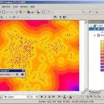
SuperGeo Technologies introduces SuperGIS Spatial Analyst 3, the spatial processing tool working with SuperGIS Desktop 3.1 to complete advanced spatial analyses and tasks. Designed for deriving information from geo-applications, the newly developed SuperGIS Spatial...