Wednesday, February 10th, 2021
REDWOOD CITY, Calif.- Skydio, the leading U.S. drone manufacturer and world leader in autonomous flight, today announced the U.S. Army elected to continue with the Skydio X2D SRR system to complete remaining integration and documentation requirements within...
Wednesday, February 10th, 2021
Planet, a leading provider of satellite imagery and geospatial solutions, is committed to delivering the necessary tools and software needed for their users to easily gather valuable insights from satellite data. To further this effort, Planet engaged...
Wednesday, February 10th, 2021
- From offline to online, Matterport's market leading technology platform turns buildings into data to deliver unparalleled property insights and analysis - With more than 250,000 subscribers in 150 countries, the business combination will enable Matterport to...
Wednesday, February 10th, 2021
AUSTIN, Texas - Sky-Futures, an ICR company, one of the world’s leading drone inspection and survey providers, has signed a global service delivery partnership with SeekOps Inc to provide methane detection, localisation, and quantification services to customers...
Wednesday, February 10th, 2021
SALT LAKE CITY - Teal Drones has accepted a multi-million-dollar investment package from Decathlon Capital Partners to fund the company’s growth and finance continued research and development efforts. The funding agreement comes as the innovative unmanned aerial...
Wednesday, February 10th, 2021
Sagetech Avionics, an aerospace technology company providing industry-leading situational awareness solutions for Unmanned Aerial Systems (UAS), announced today that on February 5th the DoD AIMS Program Office issued the world’s first 17-1000 Mark XIIB certification to Sagetech for its MX12B...
Wednesday, February 10th, 2021
Kansas City, MO – After tallying nearly 6,000 votes from public works professionals internationally, the American Public Works Association (APWA) has announced its Top Five Trending Technologies for 2021. APWA’s Top Trending Technologies initiative is unique in highlighting trending technologies with practical...
Wednesday, February 10th, 2021
Powerful, comprehensive solution improves efficiency, reduces costs and increases visibility into geospatial data – from acquisition to delivery HOLLYWOOD, Fla. – NV5 Geospatial, powered by Quantum Spatial, North America’s largest geospatial data firm, today launched INSITE, a...

Tuesday, February 9th, 2021
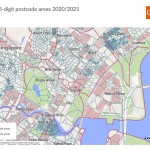
GfK released a new and completely overhauled digital map edition for all of Asia. The edition features coverage of 49 countries, ranging from the three BRICS nations Russia, India and China to smaller countries such as Bahrain...
Tuesday, February 9th, 2021
TORONTO, Ontario, Canada – Space-SI, the Slovenian Centre of Excellence for Space Sciences and Technologies, released the first multispectral image captured by its NEMO-HD Earth observation microsatellite just 16 days after launch. Built by Space Flight Laboratory...