Wednesday, December 14th, 2016
Edinburgh/London, 14 December 2016 - Ecometrica has been named on the prestigious Deloitte 2016 Technology Fast 500™ Europe, the Middle East and Africa (EMEA) list, following a year of rapid growth and important developments for the sustainability...

Tuesday, December 13th, 2016
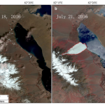
The Journal of Glaciology recently published the first account from scientists at the Institute of Tibetan Plateau Research of the Chinese Academy of Sciences (ITPCAS) concerning a glacier that collapsed on July 17, 2016, killing nine local...
Tuesday, December 13th, 2016
G170-V, a VTOL (vertical take-off and landing) fixed-wing UAV, is the latest UAV German-based GerMAP has added to the remote sensing and aerial mapping market. G170-V ideally combines the easiness of manual or automatic vertical take-off and...
Tuesday, December 13th, 2016
The Korean government had rejected offshore release of detailed local mapping data. However, this time, the government showed a contradictory attitude after a civil complaint about its rejection was submitted, creating some controversial responses from the public....
Tuesday, December 13th, 2016
The Hydrographic Society UK, which also maintains an overseas membership drawn from nearly 45 countries, has launched an annual student and graduate paper Award scheme dedicated to the memory of Alan Ingham, founder member of the original...
Monday, December 12th, 2016
Beijing - China launched a weather satellite at 12:11 am local time on Sunday, making an upgrade of China's meteorological geostationary orbit. Read More at News Gram
Monday, December 12th, 2016
TORONTO - SolidCAD, an Autodesk Platinum Partner reseller in Canada is pleased to announce a new partnership with North America's leader in commercial UAV technologies, 3DR. SolidCAD can now market, sell and support 3DR's Site Scan bundle...
Monday, December 12th, 2016
Mumbai - Rolta India Limited (Rolta), a leading provider of innovative IP-led IT solutions for many vertical segments, including Defence/HLS, today announced unaudited financial results under INDAS for quarter ended September 30, 2016 (Q2 FY -17). FINANCIAL HIGHLIGHTS Consolidated Revenue for...
Monday, December 12th, 2016
DENVER, Dec. 12, 2016 – The U.S. Air Force approved Lockheed Martin’s (NYSE: LMT) design to upgrade the current GPS satellite ground control system with new capabilities that will enable it to operate more powerful and accurate...
Friday, December 9th, 2016
SolidCAD, an Autodesk Platinum Partner reseller in Canada is pleased to announce a new partnership with North America's leader in commercial UAV technologies, 3DR. SolidCAD can now market, sell and support 3DR's Site Scan bundle across Canada...